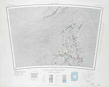
Thomas Hills (Antarctica)
[1] Download coordinates as: The Thomas Hills run in a northeast direction between the Foundation Ice Stream and the MacNamara Glacier.
A ridge-like mountain, 865 metres (2,838 ft) high, standing 2 nautical miles (3.7 km; 2.3 mi) southwest of Nance Ridge.
A rock ridge 2 nautical miles (3.7 km; 2.3 mi) northeast of Mount Yarbrough.
A peak, 1,045 metres (3,428 ft) high, standing 2 nautical miles (3.7 km; 2.3 mi) northeast of Nance Ridge.
A mountain, 915 metres (3,002 ft) high, standing 3 nautical miles (5.6 km; 3.5 mi) northeast of Martin Peak.