Mayurbhanj district
[4] Although the previous name of the territory remains uncertain, it was referred to as Khijjinga mandala and colloquially Bhanjabhumi, signifying the land of Bhanja.
[6] The archaeological findings suggest that human settlements in the Mayurbhanj district date back to the Lower Paleolithic era of the Stone Age.
The presence of a consistent water source not only supported early human inhabitants but also attracted wildlife from the Similipal forest, facilitating the hunting of smaller animals from the safety of caves.
Initially, the tools used by these early settlers were quite basic, resembling split pebbles with minimal flaking, similar to those found in Paleolithic industries in Africa.
[7][8][9] These tools evolved over time to include handaxes, cleavers, scrapers, knives, rostrocarinates, and points, varying in complexity, shape, and size.
Typo-technological analysis suggests the presence of two specific tool types with manufacturing techniques akin to European Abbevilian, Acheulian, and Clactonian industries.
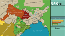
The progenitor of present-day Bhanjas of Khijjinga mandala divided the territory into two segments, each led by one ruler, effectively forming two full-fledged states.
During Mughal conquest from 1592 to 1751, Mayurbhanj was an extensive domain that comprised 12 Zamindari, 42 kila in total, and, according to Raja Man Singh, 18 forts within the state, including Bhanjbhum, Mantri, Hariharapur, Dewalia, Purunia, Karkachua, Bamanghati, and Sarhonda.
The state also held sway over several surrounding Zamindari Estates, including Nilgiri, Porahat, Saraikela, Kharsawan, Barabhum, Patharhai, Narsinhpur, Dipa Kiarchand, Jhamirapal, Jamkunda, Chargarh, Talmunda, Tamar, and Birkul during the early period of Mughal rule.
Raja Krushna Chandra Bhanja took advantage of the disturbed conditions around the last years of Shah Jahan and enlarged his territory to the coast of the Bay of Bengal, covering the area from Jaleswar to Bhadrak.
The left-out westernmost territory of the Mayurbhanj state, stretching up to the Porahat estate, retained its independence during both Mughal and Maratha invasions.
During Sriram Chandra's reign, major infrastructure and administrative developments took place, including the construction of the narrow-gauge railway from Rupsa to Baripada and from Gorumahisani mines to Jamshedpur.
They are mostly flat with small hills and slopes but are at a higher altitude than the eastern plains, the height rising from north to south.
The Simlipal Hills influence the weather substantially and exhibit higher rainfall and lower maximum temperatures than the rest of the district.
The road network of Mayurbhanj is organised in a circular manner owing to the presence of the Simlipal Hills and forest in the centre of the district, which were first constructed in the early 20th century by the rulers of the state.
It shortly thereafter enters the district and passes the major villages of Baisinga, Betnoti and Krushnachandrapur before crossing Baripada and Jharpokharia.
There are four territorial subdivisions of the district – Sadar (headquartered at Baripada), Kaptipada (Udala), Bamanghaty (Rairangpur) and Panchpir (Karanjia) composing 26 blocks, 382 Gram panchayats and 3945 villages.
While the Superintendent reports on general law and order matters to the District Magistrate, he is almost completely independent in practice as far as the police force is concerned.
The GPs and Blocks report to the Project Director, District Rural Development Authority (DRDA), an ADM rank officer.
The Simlipal National Park, while formally a part of the four subdivisions noted above, is in practice under a Field Director belonging to the Indian Forest Service (IFS).
[2] The bulk of the population is concentrated in the Sadar and Kaptipada subdivisions which border the fertile coastal Odisha plains and are part of an extensive rice growing region.
A distinctive feature is the presence of many communities that originally hailed from West Bengal but have completely integrated with the Odia population in the last two centuries.
As per 1931 census, the district was comprised by 131 different communities, primarily by Santal (28.61%), Ho (Kolha) (12.07%), Bhumij (8.71%), Kudmi Mahato (6.77%), Bathudi (5.19%), Goura (4.39%), Pana Tanti (3.38%), Bhuyan (2.62%), Khandaita (2.23%), Bhanja Purana (2.2%) and other communities like Kamar, Kumbhar, Gond, Kharia, Brahmin, Teli, Saunti, Dhoba, Tanti, Gola, Dom, Bhandari, Karana, Patra, Baisnaba, Ghasi, Sadgop, Mahali, Sabara, Amanta, Sundhi, Pan (Jena Pan), Purana, Keut, Hadi, Dhandachhatra Majhi, Raju, Kshatriya, Ujia, Bagal, Gouria, Rarhi, Oraon, Baisa, Karua, Thatari, Sahara, Kayastha, Rajuar, Munda constitute 20.35% with each community shared by 0.9% to 2.0%.
[34] According to the 2011 Census 83.86% (2,113,079) people are Hindus, 1.34% (33,706) are Muslims, 0.6% (15,008) are Christians, 0.03% (661) are Sikhs, 0.01% (162) are Buddhist, 0% (109) Jains, and 0.21% (5,299) didn't stated any religious affiliation, while the rest 13.96% (351,714) are adherent of tribal faiths (primarily Sarnaism) and other unclassified sect and beliefs.
[35] Hinduism in the district is practiced by most of its inhabitants through various sects and a blend of traditions, with a legacy of c. 8th-century Shaktism at the Kichakeshwari Temple in Khiching, c. 15th-century Vaishnavism in Haripur, alongside the ancient Jagannath cult, and the fl. c.
Buddhism and Jainism, although forming an insignificant portion of the current population, historically flourished in the region before the emergence of the Bhanja dynasty.
At present, semi-Buddhistic practices, including the worship of Mahayana deities such as Tara and Avalokiteshvara under different names, are observed in some rural areas.
[d]At the time of the 2011 Census of India, 54.33% of the population in the district spoke Odia, 24.81% Santali, 7.58% Ho, 3.92% Mundari, 2.77% Kurmali and 1.34% Bengali as their first language.
Kudmali is another important language, primarily spoken by the Kudumi Mahato in the border areas of Jharkhand and West Bengal.
Mayurbhanj District is also associated with Jhumar, a popular traditional folk song that reflects the community's celebrations, marriages, social functions, sorrows, and joys.