Medway Gap
It was created when the prehistoric River Medway cut roughly south to north through the line of chalk hills[1] now known as the North Downs;[2] other rivers such as the Darent and the Stour have similar features.
Its past significance as a means of travel is indicated by the prehistoric Medway megaliths in the area.
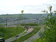
At the north end of the Medway Gap, the river is crossed by the M2 motorway and High Speed 1 viaducts.
The Gap is designated as a Biodiversity Opportunity Area by Kent County Council.
[3] It also has the effect of creating local weather patterns, thereby frequently exhibiting opposite conditions to the surrounding countryside.