Minnesota State Highway 7
The section that is now an expressway in the Twin Cities was expanded by the 1950s, and the whole highway was paved in a hard-surface by the end of that decade.
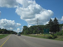
From here, MN 7 passes through farm fields before turning southeasterly along the shore of Big Stone Lake.
The lake is the source of the Minnesota River and forms the Minnesota–South Dakota state line in Big Stone County.
South of the end of the lake, MN 7 merges with US 12, and the two highways run concurrently for about a couple blocks.
The roadway also runs parallel to a line of the BNSF Railway used by the Twin Cities and Western Railroad in the area.
At the intersection with Minnesota Street near the Swift County Fairgrounds, US 59/MN 7 turns southeasterly separating from MN 119.
The highway then continues southeasterly running inland from Lac qui Parle through farm country to the town of Milan.
[6][12] Continuing northward in Montevideo, the highway turns back to the east between J. Harley Smith and Lagoon parks.
The highway crosses another line of the BNSF Railway and MN 23 in Clara City before meandering southwesterly to follow 60th Street near Bunde.
The highway follows 195th Avenue through the southern part of the county, passing through the communities of Prinsburg and Lake Lillian.
Running due east through farmlands in the southern area of that county, the highway intersects MN 4 in Cosmos and passes through Cedar Mills.
The highway passes several parks before coming to an intersection with MN 15 and exiting the business district for residential neighborhoods.
[6][12] In rural eastern McLeod County, MN 7 jogs to the north around Silver Lake in the city of the same name.
This divided highway has a partial interchange with Mill Street in Excelsior near the St. Albans Bay of Lake Minnetonka.
The highway passes north of the campus for Minnetonka High School near the intersection with County Road 101 (CR 101).
Access to MN 7 through the area is restricted to major intersections only for the most part, making the highway an expressway rather than a true freeway.
The area immediately adjacent to MN 7 in this suburb is filled with commercial properties on either side of access roads.
[20][21] From 1965 to either 1987 or 1988, the eastern terminus was located at the intersection of Lake Street and France Avenue in Minneapolis; the part, about one mile (1.6 km) long, between the interchange with MN 100 and the intersection of Lake Street and France Avenue is now called County State-Aid Highway 25.