Mississippi Highway 33
It runs from north to south for 55.7 miles (89.6 km) and serves the counties of Jefferson, Franklin, Amite, and Wilkinson.
It heads north through woodlands, then farmland for several miles, passing through Whitaker before entering the Centreville city limits and becoming concurrent (overlapped) with MS 24.
MS 33 immediately re-enters the National Forest for the next several miles, exiting only briefly at times to pass through the communities of Knoxville, Franklin, and the town of Roxie, where it has an intersection with US 84 (formerly also part of US 98).
The highway travels through more remote woodlands of the forest for several miles to pass through the community of Hamburg to cross into Jefferson County.
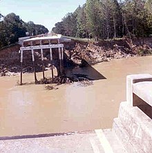
This resulted in increased stream flow velocity, causing accelerated erosion and scour, which in turn leads to bank instability.