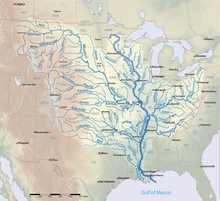
Mississippi River floods of 2019
Flooding in the Mississippi River Basin during the winter, spring, and summer of 2019 caused at least 12 deaths and economic losses in 19 states totaling in excess of $20 billion.
[1][2] In addition to property and crop losses and infrastructure damages, commercial navigation on the Mississippi River was interrupted repeatedly by high currents, low bridge clearances, and closed locks.
This delayed shipments of agricultural commodities, adding to the economic stress of crop losses caused by flooding.
[10][11][12] Wetter than normal conditions persisted into the spring with precipitation concentrated in the western and northern regions of the Mississippi River Basin.
In mid-March, snow-melt accelerated by heavy rain and rapidly warming temperatures resulted in catastrophic flooding in portions of the Midwestern United States.
Precipitation over the 12-month period ending in May averaged 37.72 inches (958 mm) surpassing the record set one month earlier.
[18] Wetter than normal weather continued into June, and for the third month in a row, a new record was set for 12-month precipitation averaged over the conterminous United States.
[19] Normally, floods on the Lower Mississippi River occur in the winter and spring, and thus are unlikely to overlap with the Atlantic hurricane season.
[23] On the afternoon of 1 June 2019, a temporary flood barrier failed forcing evacuation of multiple businesses in a 4 to 5 block area of downtown Burlington.
[23] The Pin Oak levee in Lincoln County, Missouri overtopped in early hours of Sunday morning, 2 June 2019, and breached that afternoon.
Approximately 250 people were forced to evacuate as flooding threatened or isolated about 150 homes in Winfield, Missouri, and surrounding areas.
[34] Over water year 2019, the annual mean river discharge at Memphis, Tennessee, was 1,001,000 cubic feet per second (28,300 m3/s), the highest value in the 1933 to 2019 period of record and almost twice the long-term average.
[35] At Vicksburg, Mississippi, tributary inflows from the St. Francis, White, Arkansas, and Yazoo Rivers increased the annual mean discharge to 1,211,000 cubic feet per second (34,300 m3/s).
[34] In his letter of 19 July 2019 requesting a major, federal disaster declaration, Mississippi Governor Phil Bryant wrote “To say that the persistent flooding in these five Mississippi Delta counties has had a devastating impact on the lives of many Mississippians would be a gross understatement.” He noted that prolonged flooding was impacting the livelihood of thousands of agricultural workers in one of the most impoverished areas of the United States.
[34][40][41] The Eagle Lake community, in northwestern Warren County, Mississippi, succumbed to flood water ponding in the Yazoo Backwater Area over the weekend of 18 May 2019.
The EPA determined that the proposed pumping station would adversely impact 105 square miles (67,000 acres; 27,000 hectares) of wetlands.
The USACE plan included provisions for reforestation of up to 87 square miles (56,000 acres; 23,000 hectares) of developed, low-lying lands that would not be protected from flooding by the proposed pumping station.
The Steele Bayou Drainage Structure was closed from 15 February 2019 to 1 April 2019, and water levels on the protected side peaked at 97.2 feet (29.6 meters).
Water levels fell to 95.4 feet (29.1 meters) before a new rise on Mississippi River forced closure of the Steele Bayou Drainage Structure from 11 to 23 May 2019.
The Steele Bayou Drainage Structure was reopened on 20 June 2019 after the Mississippi River fell below 49.3 feet at the Vicksburg gage.
[Notes 2] The Steele Bayou Drainage Structure was closed again briefly from 7 to 11 July 2019 as the Mississippi River rose to 49.6 feet (15.1 m) on the Vicksburg gage, pushing water levels on the river side of the structure slightly above levels on the protected side.
The planned operation was postponed (and eventually cancelled) when subsequent forecasts indicated that stages would be lower than originally predicted.
The Spillway is operated to limit the Mississippi River flow passing New Orleans, Louisiana, to the project design flood discharge of 1.25 million cubic feet per second (cfs).