Mississippi Valley Loess Plains (ecoregion)
The North American Mississippi Valley Loess Plains are a Level III ecoregion designated by the Environmental Protection Agency (EPA) in six U.S. states.
[1] In the more gently rolling plains portion to the east, upland forests are dominated by oaks, hickories, and both loblolly and shortleaf pine.
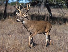
[1] Common species include white-tailed deer, red fox, raccoon, weasel, gray squirrel, wood thrush, Carolina wren, bobwhite quail, mourning dove, wild turkey, and bayou darter.
[1] Agriculture is typical in the Kentucky and Tennessee portion of the region, while in Arkansas, Mississippi, and Louisiana there is a mosaic of forest, pine plantations, pasture, and cropland.
Larger towns and cities include Paragould, Jonesboro, Mayfield, Memphis, Holly Springs, Grenada, Vicksburg, Jackson, Brookhaven, McComb, and Baton Rouge.
[1] The following federally protected areas lie within this ecoregion: The Bluff Hills consist of sand, clay, silt, and lignite, and are capped by loess deposits often greater than 50 feet (15 m) thick.
Other common forest trees include sweetgum (Liquidambar styraciflua), basswood (Tilia americana), eastern hophornbeam (Ostrya virginiana), and tulip poplar (Liriodendron tulipifera), while forests in the southern part of the region contain more southern magnolia (Magnolia grandiflora), water oak (Quercus nigra), and Spanish moss (Tillandsia usneoides).
[2] In the northern part of the region, in Kentucky, sugar maple (Acer saccharum) and bitternut hickory (Carya cordiformis) appear.
[3] The cool ravines contain some higher gradient streams and areas of gravel substrate, creating distinct aquatic habitats.
Crowley's Ridge, with elevations of up to 500 feet (150 m), is of sufficient height to have trapped wind-blown silt during the Pleistocene Epoch.
The loess layer tends to be thinner than neighboring 74a, and thins more to the east in the broad transition to the Southeastern Plains.
Streams and rivers tend to be low gradient and murky with silty and sandy substrates; many have been channelized.
[2] In Tennessee, several large river systems with wide floodplains—the Obion, Forked Deer, Hatchie, Loosahatchie, and Wolf—cross the region.
It is mantled by thick loess and alluvium and is underlain by weak, unconsolidated coastal plain sediments.
The soils are mostly Alfisols with brown or grayish-brown, silt loam surfaces that developed in the loess parent materials.