Southeastern Plains (ecoregion)
The North American Southeastern Plains are a Level III ecoregion designated by the Environmental Protection Agency (EPA) in ten U.S. states.
Birds include eastern wild turkey, northern cardinal, Carolina wren, wood thrush, tufted titmouse, hooded warbler, summer tanager, herons, and egrets.
Agriculture includes corn, cotton, soybeans, peanuts, onions, sweet potatoes, melons, tobacco, poultry, and hogs.
The natural vegetation had dominant trees of sweetgum, post oak, and red cedar, along with patches of bluestem prairie.
The Flatwoods consist of a mostly forested lowland area of little relief, formed primarily on dark, massive marine clay.
The Blackland Prairie Margins are undulating, irregular plains, with slightly more relief than the Flatwoods, but also tend to have heavy clay soils that are sticky when wet, hard and cracked when dry, with generally poor drainage.
[4] The Sand Hills of Georgia form a narrow, rolling to hilly, highly dissected coastal plain belt stretching across the state from Augusta to Columbus.
The region is composed primarily of Cretaceous and some Eocene-age marine sands and clays deposited over the crystalline and metamorphic rocks of the Piedmont (45).
[4] The Northern Hilly Gulf Coastal Plain ecoregion contains several north–south trending bands of sand and clay formations, and extends north to the Kentucky–Tennessee border.
The marl and sand surficial materials have weathered into a reddish surface color, contrasting with the darker soils of adjacent 65a and 65b.
[5] The Southern Pine Plains and Hills have a different mix of vegetation and land use compared to 65d, and streams tend to be darker tea-colored and more acidic as one moves south.
[4] The Tifton Upland of Georgia has more rolling, hilly topography compared to 65g and 75e, with a mosaic of agriculture, pasture, and some mixed pine/hardwood forests.
On the west side of the region, the Pelham Escarpment has bluffs and deep ravines with cool microclimates that support several rare plants and animals, as well as species with more northern affinities.
Longleaf pine is being reintroduced in many parts of the region, and the area around the Talladega National Forest in west Alabama provides a major stronghold for the endangered red-cockaded woodpecker.
Cretaceous-age coastal plain deposits of silt, sand, clay, and gravel, however, overlie the older limestone, shale, and chert.
[4] Also called the Vidalia Upland in Georgia, the Atlantic Southern Loam Plains ecoregion is generally lower, flatter, and more gently rolling than 65k, and has more cropland and finer-textured soils than 75f.
Similar to 65h, it has an abundance of the agriculturally important Tifton soils, but the region also contains forested areas that are more sloping or are low, flat and poorly drained.
Parallel to some of the major stream courses are some excessively-drained, dunal sand ridges with xeric vegetation such as longleaf pine / turkey oak forests, and some distinctive evergreen shrubs, such as rosemary and woody mints.
It has a slightly cooler and shorter growing season than 65l, but is a productive agricultural region with typical crops of corn, soybeans, tobacco, cotton, sweet potatoes, peanuts, and wheat.
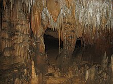
The Floridan aquifer is thinly confined in this region, and streams are often intermittent or in parts flow underground in the karst landscape.
[4] Southeastern Floodplains and Low Terraces are a riverine ecoregion of large sluggish rivers and backwaters with ponds, swamps, and oxbow lakes.
The calcareous clay, sand, and marl is commonly overlain by alkaline, clayey soils that expand when wet and shrink when dry.
Efforts are being made to maintain the prairie species with controlled burning and other management programs on national forest lands.