Missoula floods
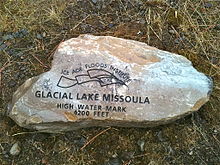
These floods were the result of periodic sudden ruptures of the ice dam on the Clark Fork River that created Glacial Lake Missoula.
After each ice dam rupture, the waters of the lake would rush down the Clark Fork and the Columbia River, flooding much of eastern Washington and the Willamette Valley in western Oregon.
U.S. Geological Survey hydrologist Jim O'Connor and Spain's Museo Nacional de Ciencias Naturales scientist Gerardo Benito have found evidence of at least twenty-five massive floods, the largest discharging about 10 cubic kilometers per hour (2.7 million m³/s, 13 times that of the Amazon River).
Bretz coined the term Channeled Scablands in 1923 to refer to the area near the Grand Coulee, where massive erosion had cut through basalt deposits.
Bretz published a paper in 1923 arguing that the Channeled Scablands in Eastern Washington were caused by massive flooding in the distant past.
Both Pardee and Bretz continued their research over the next 30 years, collecting and analyzing evidence that led them to identify Lake Missoula as the source of the Spokane flood and creator of the channeled scablands.
[9] The Cordilleran ice sheet formed a glacial dam across the Clark Fork valley, creating a large lake just south of modern-day Sandpoint.
[11]: 30 As the water emerged from the Columbia River gorge, it backed up again at the 1 mile (1.6 km) wide narrows near Kalama, Washington.
Glacial deposits overlaid with centuries of windblown sediments (loess) have scattered steep, southerly sloping dunes throughout the Columbia Valley, ideal conditions for orchard and vineyard development at higher latitudes.
[12][9] The cumulative effect of the floods was to excavate 210 cubic kilometres (50 cu mi) of loess, sediment, and basalt from the Channeled Scablands of eastern Washington and to transport it downstream.
By analogy, since there were 40 layers with comparable characteristics at Burlingame Canyon, Waitt argued they all could be considered to have similar separation in deposition time.
This discharge, if occurring concurrently with the breach of the Lake Missoula ice dam, would have provided significantly larger volumes of water.
Further, Shaw and the team proposed that the rhythmic Touchet beds result from multiple pulses or surges within a larger flood.
Their major findings were that the calculated water depth in each flooded location except for the Spokane Valley–Rathdrum Prairie was shallower than the field evidence showed.