Missouri Bootheel
John Hardeman Walker, a pioneer planter in what is now Pemiscot County, argued that the area had more in common with the Mississippi River towns of Cape Girardeau, Ste.
Another legend has the adaptation made by a lovestruck surveyor to spare the feelings of a widow living 50 miles south of the Missouri border, but unaware of it.
[5] Meanwhile, the boll weevil ruined the cotton crop in Arkansas, and planters moved into the Bootheel, bought up the new lands or leased them from insurance companies that had invested in the area, and recruited thousands of black sharecroppers as workers.
[3] During the 1910s, the Bootheel experienced a surge in racial violence as white tenant farmers attacked black workers who were imported by landowners from the South.
An ally of Senator and President Harry S. Truman, Conran packed the ballot boxes but did bring efficiency and government services, and helped improve economic and social conditions.
[10] During the Great Depression, the Farm Security Administration said that the Bootheel was a "paradox of rich land and poor people."
The Farm Security Administration, a New Deal agency, responded by providing low-cost rental housing for 500 cropper families.
The lowest point in the state is in southwestern Dunklin County along the St. Francis River near Arbyrd, at 230 feet above sea level.
The entire landscape was transformed into farmland by extensive logging, draining of the watershed, channelization, and the construction of flood control structures.
High levees along both river courses, an extensive system of drainage ditches and diversion channels, and controlled lakes, pumping stations and cutoffs protect the area from flooding.
The soils are predominantly a rich and deep glacial loess, alluvial silt, and a sandy loam, well-suited for agricultural use.
The reduction in wetlands has reduced important habitats for many species of migratory birds and a variety of fish and animals.
The National Weather Service reported that from 1980 to 2002, nine floods in the United States had total losses exceeding one billion dollars.
An eyewitness of the earthquakes of 1811 and 1812 noted: Great fissures opened the earth, geysers show mud and rocks hundreds of feet in the air, new hills and ridges heaved up out of the ground, and the river itself ran red with brimstone and sulfur.
Whole islands in the river disappeared, the forests went under, the tall oaks snapped like twigs, and violent winds tossed bundles of fallen timbers.
Remote settlements along the river banks, miles from paved roads, provided an ideal environment (and market) for moonshining and bootlegging.
Definitions of the Mid-South vary but in general include west Tennessee and Kentucky, north Mississippi, northeast Arkansas, and the Missouri Bootheel.
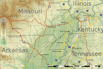
Cape Girardeau and Poplar Bluff are often considered to be part of the Bootheel due to the influence the two cities have had on the development of the region, but neither is located within its geographic boundaries.
Hornersville, a small town in southern Dunklin County, was home to William H. "Major" Ray, a one-time 19th-century circus "midget".
[18][19] The Missouri Bootheel is the home of two members of the musical group the Kentucky Headhunters, Doug and Ricky Phelps.
They performed at the Cotton Pickin Festival in the small town of Arbyrd; a place where they spent much time while growing up.
[20][21][22] Also in the northern part of Dunklin County lies the town of Malden, the home of country/rockabilly singer Narvel Felts.