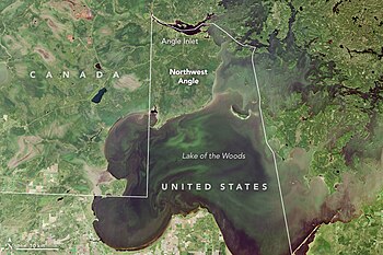
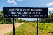
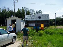
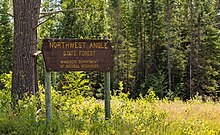
Northwest Angle
Seventy percent of the land of the Angle is held in trust by the Red Lake Indian Reservation (Ojibwa).
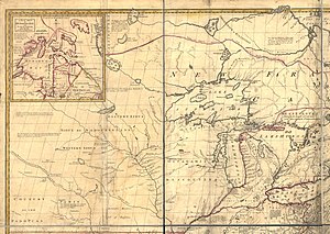
Benjamin Franklin and British representatives relied on the Mitchell Map of colonial American geographer John Mitchell, which did not indicate the source of the Mississippi River—thought to lie some distance to the northwest—or the true shape of Lake of the Woods, which was instead shown as roughly oval.
Additionally, the irregular actual shape of the lake made the identification of its northwest corner difficult.
In 1797, it was confirmed when David Thompson, an explorer, located the most northerly source of the Mississippi a few miles north of Bemidji, which is south of Lake of the Woods.
As part of the negotiations over that treaty, both parties agreed to revisit the boundary west from the Lake of the Woods.
Another survey team, led by David Thompson in 1824, mapped the lake and found four possibilities for the northwesternmost point, but did not conclusively declare one location.
Tiarks identified two possibilities for the northwesternmost point on the lake, based on Thompson's maps: the Angle Inlet and Rat Portage.
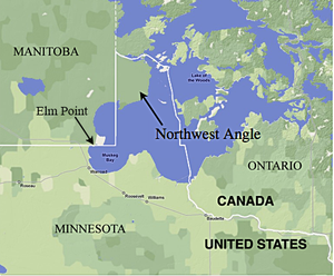
The placement of the northwestern corner and shape of the lake meant that this north–south line cut off a section of U.S. territory to its east, now known as the Northwest Angle.
The land includes several islands, including Oak Island, and two small capes that are below (south of) the 49th parallel north in the extreme southwest part of the township, one of which is known as Elm Point, south of the southeast corner of Manitoba, and not far from the northeast corner of Roseau County.
Elm Point, in Lake of the Woods County, is a small cape southwest of the Northwest Angle.
It borders Canada and is, together with a similar smaller cape to the west, separated by land from the continental United States.
[1] The following year, then-U.S. representative Collin Peterson of Minnesota proposed legislation to allow the residents of the Northwest Angle, which was part of his district, to vote on seceding from the United States and joining Canada.
This angered the leaders of Red Lake Indian Reservation, which holds most of the Northwest Angle's land.
During the winter months, the average annual extreme minimum air temperature is −38.0 °F (−38.9 °C),[16] putting it in hardiness zone 3a.