Moderate Resolution Imaging Spectroradiometer
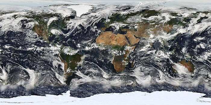
The Moderate Resolution Imaging Spectroradiometer (MODIS) is a satellite-based sensor used for earth and climate measurements.
MODIS has now been replaced by the VIIRS,[citation needed] which first launched in 2011 aboard the Suomi NPP satellite.
They are designed to provide measurements in large-scale global dynamics including changes in Earth's cloud cover, radiation budget and processes occurring in the oceans, on land, and in the lower atmosphere.
Examples of such applications are the monitoring of vegetation health by means of time-series analyses with vegetation indices,[3] long term land cover changes (e.g. to monitor deforestation rates),[4][5][6][7] global snow cover trends,[8][9] water inundation from pluvial, riverine, or sea level rise flooding in coastal areas,[10] change of water levels of major lakes such as the Aral Sea,[11][12] and the detection and mapping of wildland fires in the United States.
[13] The United States Forest Service's Remote Sensing Applications Center analyzes MODIS imagery on a continuous basis to provide information for the management and suppression of wildfires.