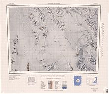
Monument Nunataks
A mountain, 1,690 metres (5,540 ft) high, standing 2.5 nautical miles (4.6 km; 2.9 mi) north of Mount Allison.
Mapped by the United States Antarctic Research Program (USARP) Victoria Land Traverse Party, 1959-60.
A mountain, 1,995 metres (6,545 ft) high, standing 5 nautical miles (9.3 km; 5.8 mi) north of Mount VX-6.
Stuart, glaciologist and member of the United States ArmyRP Victoria Land Traverse Party which surveyed this area in 1959-60.
A distinctive, sharp mountain, 2,185 metres (7,169 ft) high, standing 4 nautical miles (7.4 km; 4.6 mi) north of Minaret Nunatak.
They named it for United States Navy Air Development Squadron Six (VX-6) which supported the traverse party in the field.
Named by US-ACAN for Willis A. Burkett, aviation electronics technician of United States Navy Squadron VX-6.
A prominent rock spur that forms the southwest portion of Sculpture Mountain at the south end of Monument Nunataks.
[14] This article incorporates public domain material from websites or documents of the United States Geological Survey.