Morrison County, Minnesota
[2] Camp Ripley Military Reservation occupies a significant area in north-central Morrison County.
The county was named for fur trading brothers William and Allan Morrison.
In the 19th century three prominent explorers led expeditions along the river through the area that became Morrison County.
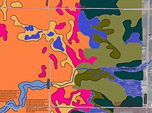
Explorer and scientist Joseph Nicollet created the first accurate map of the area along the river in 1836.
The Reverend Frederic and Elisabeth (Taylor) Ayer moved to the Belle Prairie area in 1849.
[3] It was named for William and Allen Morrison, early fur trappers and traders in the area.
[4] The event that prodded further development of the county was the building of Fort Ripley (originally named Ft. Gaines).
In order to construct this military outpost, the Little Falls Mill and Land Company built a dam and sawmill in 1849.
Fort Ripley was ostensibly built to protect the Winnebago Indians, who had been relocated by Henry Rice from Iowa to central Minnesota west of the Mississippi River, between the Crow Wing and Long Prairie rivers.
His plan was unsuccessful and in 1855 the Winnebago were moved to the Blue Earth River in southern Minnesota.
This dam washed out, as had the first, and Little Falls entered a long period of economic depression and stagnant population.
To be sure their investment would succeed, they encouraged other major industries to move to the city, touting the water power.
Pine Tree Lumber Company, run by Charles A. Weyerhaeuser and Richard "Drew" Musser,[7] was one business that took advantage of the water power, with their operations in Little Falls beginning in 1890.
The terrain consists of low rolling hills, partly wooded, carved with drainages and gullies, and with all available area devoted to agriculture.