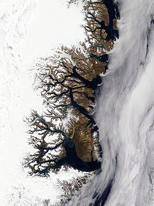
Muskox Fjord
Administratively it lies in the Northeast Greenland National Park area.
Muskox Fjord was mapped in 1899 during the Swedish Greenland Expedition in search of survivors of S. A. Andrée's Arctic balloon expedition of 1897 led by Swedish Arctic explorer Alfred Gabriel Nathorst (1850–1921).
It was named Moskusoksefjorden after the muskox of which Nathorst saw a quite large herd near the shores of the fjord, one of the areas in East Greenland providing a habitat for this resilient Arctic mammal.
[2] Muskox Fjord separates Hudson Land in the north from the Gauss Peninsula in the south.
There are up to 1,220 metres (4,000 ft) high mountains on both sides of the mouth area of the fjord, where there are some places with good anchorages.