National Cycle Route 51
It now uses a section of road that used to form the Eastbound carriageway of the A14 at Haughley Bends[1] and has been turned into a traffic free route for cyclists, walkers and horse riders as shown on the official map[2] of the works.
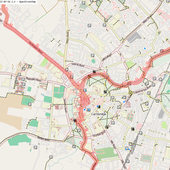
Then via the old stone bridge from St Ives to Hemingford Abbots and Grey, then via Cow lane into Godmanchester and generally east towards Huntingdon railway station.
[4] From here, the route follows the trackbed of the old Varsity Line, now a rail trail, briefly joining the public highway at the village of Blunham, past Willington and the wetlands around Priory Marina, before arriving at the outskirts of Bedford where it follows the south bank of the River Great Ouse through parkland to the south end of Bedford Bridge.
This section is prone to flooding, and an alternative cycle route is available by crossing County Bridge and following Prebend Street south to the Bedford Road cycleway.
NCR 51 follows a split cycle path (pedestrians/cycles separated by solid white line) through Kempston, past a supermarket, and through alleyways to Ridgeway School.
From the limits of Kempston, there is a well-marked route on roads, crossing the Bedford western bypass via Wootton to Marston Moretaine The route travels through the Forest of Marston Vale (bike hire in the Forest centre) where there is a cycleway connecting with Millbrook railway station.
Milton Keynes | Winslow | Bicester | Oxford From Milton Keynes Central railway station, the route goes over the West Coast Main Line on a pedestrian/cycle bridge, and follows paved routes in parkland past the National Bowl and Furzton Lake to the A421 junction with Buckingham Road in West Bletchley.