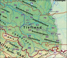
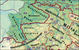
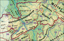
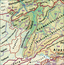
Natural regions of Germany
This division of Germany into major natural regions takes account primarily of geomorphological, geological, hydrological, and pedological criteria in order to divide the country into large, physical units with a common geographical basis.
This divided the present federal territory (then West and East Germany) into 86 [1] so-called major landscape unit groups (Haupteinheitgruppen) each with a two-digit number between 01 and 90.
These, in turn, were subdivided into up to ten, in some cases more, major landscape units (Haupteinheiten), each with a three-digit number.
In the subsequent work at 1:200,000 scale that lasted until the 1990s, that further split the landscape regions into a fifth and lower levels (using the three-digits numbers supplemented with further numbers placed after a decimal comma), it became apparent that the boundaries of major regions at the second and third levels had to be corrected in several places and, in individual cases, were no longer compatible with boundaries of the major unit groups.
Germany can be divided into three major geographical regions: the Northern Lowland or North German Plain, the Central Uplands, and the Alps running roughly west to east across the country.
Within a secondary or tertiary landscape region the list follows the numerical order in the handbook; the BfN's numbers are given in brackets.
The English names are primarily based on Dickinson (1964)[8] and Elkins (1972)[6] where their classification corresponds closely to the handbook's.
(to 933 Inn Valley Riffkalkketten) The Central Alps lies completely outside of Germany and are only mapped at the fringes.