New Jersey Route 33
The route traverses through historic towns such as Hightstown, Monroe Township, Manalapan, Freehold, and Tinton Falls.
At this point, Greenwood Avenue ends, and Route 33 merges with Nottingham Way and becomes a four-lane boulevard lined with many homes and businesses.
After reaching a modified interchange with I-295, Route 33 turns right off of Nottingham Way and becomes a two-lane surface road with a center left-turn lane.
The road passes through woods before emerging into Hightstown, where it serves several businesses and bisects a cemetery before entering the downtown area.
Continuing east, activity along the sides of the highway disappears, and the route enters Millstone Township, Monmouth County, where businesses begin to reappear.
Crossing into Manalapan, Route 33 passes through a mix of farmland and commercial areas before reaching the western terminus of Bus.
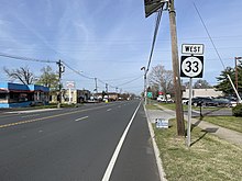
The westbound and eastbound lanes eventually split apart as the highway reaches the western terminus of Route 66 and an interchange with the Garden State Parkway.
Past this point, Route 33 becomes Corlies Avenue and enters Neptune, passing through many residential neighborhoods.
The road then crosses entirely back into Neptune and passes south of Jersey Shore University Medical Center and K. Hovnanian Children's Hospital.
However, in 1967, the New Jersey Department of Transportation scaled back proposals to the current seven-mile (11 km) Route 33.
Route 33 from near CR 527 in Manalapan to Halls Mill Road in Freehold Township was completed and opened in segments from 1971 to 1988.
[7] The original alignment for the freeway east of Halls Mill Road (CR 55) can be seen now as a New Jersey Department of Transportation maintenance shed.
The new alignment curves to the left after the interchange, in order to avoid what the New Jersey Department of Transportation believed to be a suspected (but never identified) turtle bog habitat.
(Route 33 eastbound also ascended the bridge approach about halfway before branching off like an exit ramp—a sign with flashing lights read "Hightstown, Shore Points" at the fork.)
[6] Until 2003, the intersection of US 130/Route 33 in Robbinsville was configured as an at-grade wye interchange, employing curved ramps for the directional movements.
An attempt was made to realign the ramp, though this failed, and the exit was abandoned shortly after, and is still inaccessible and rarely maintained.
[12] A bridge once carried Route 33 over the same Pennsylvania Railroad (now Conrail Shared Assets Operations) line further south in Robbinsville.
As the Conrail Shared Assets Operations line was dormant, no railroad street crossing was installed.
This new exit 8 would grant direct access to the bypass (without going through any traffic lights), as well as to Route 33, using grade-separated interchanges.
is a short state highway in New Jersey that was the original alignment of Route 33 before a freeway was built as a bypass of Freehold.
[18] However, the next year, the New Jersey Department of Transportation had to scale down the project to a new bypass of Freehold, and prevent the congestion of traffic through the borough.