New Jersey Route 71
Route 71 is a state highway in New Jersey that runs 16.7 miles (26.9 km) near the shore in Monmouth County.
Route 71 continues northward through Brielle as a two-lane highway before beginning a parallel with NJ Transit's North Jersey Coast Line.
The route continues north through Sea Girt until the intersection of 8th Avenue (CR 20), where it briefly enters Wall Township.
There, the route crosses over the North Branch of the Wreck Pond and enters Spring Lake Heights.
[3] Most of Spring Lake Heights is residential, with a large condominium complex surrounding the southbound direction on Route 71.
The highway continues northward, intersecting with Allaire Road (CR 524) and passes Marucci Park.
The route continues northward through the residential seashore community, crossing the Sylvan Creek and entering Bradley Beach.
Soon after, Route 71 turns north on Park Avenue, crosses over Deal Lake and enters Loch Arbour.
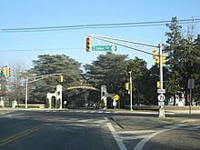
There, the route comes back together, crossing over the North Jersey Coast Line once again near the Elberon Train Station.
Here, Route 71 continues northwestward on Monmouth Road through large commercial complexes and the local country club.
Route 71 originates as part of the Jersey Coast Way, an auto trail running from the Staten Island Ferry to Cape May.
[5] Route 71 has remained virtually unchanged since the 1953 renumbering in terms of its alignment from Brielle to Eatontown.