Orderville, Utah
[5] The town was founded and operated under the United Order of the Church of Jesus Christ of Latter-day Saints.
Orderville was settled primarily by destitute refugees from failed settlements on the Muddy River in Nevada.
When it was settled, Orderville included 335 acres (136 ha) of land and contained 18 houses, 19 oxen, 103 cows, 43 horses, 500 sheep, 30 hogs, 400 chickens, and 30,000 feet of lumber.
Credits were recorded for all work done by men, women, and children and used to obtain needed materials and keep track of the labor done in the settlement.
At the beginning of each year, debts were forgiven, and those who had earned a surplus voluntarily gave it back to the order.
Ten percent of the net increase of Orderville was donated to the Church of Jesus Christ of Latter-day Saints to follow the law of tithing.
New members had to agree to follow the strict standards and conditions of the settlement, including no swearing and giving up tobacco, tea, and coffee.
When members wanted to leave, they were given back the capital they had initially invested along with their surplus credits for that year.
[7] Although the United Order was practiced in many Utah communities during the late 1870s, Orderville was unique in both the level of success it experienced under the communal living style, and in the duration of the experiment.
Orderville not only provided for the needs of its population, but produced a significant surplus for sale to other communities, which was used to purchase additional land and equipment.
Three years later the value system assigned to labor was adjusted, introducing a level of inequality that had not existed before.
While these internal conflicts and changes eventually would have led to the end of the practice of the United Order in Orderville, national legislation ensured it.
Orderville continued its tannery, wool factory, and sheep enterprise, which were overseen by the Board of Management until 1889.
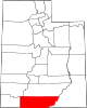
[8] Orderville is in western Kane County within the Long Valley, formed by the East Fork of the Virgin River.
According to the United States Census Bureau, the town has a total area of 9.2 square miles (23.7 km2), all land.
[9][10] From Mount Carmel Junction, Utah State Route 9 leads west 23 miles (37 km) to Zion National Park.