Pascagoula, Mississippi
Pierre Le Moyne d'Iberville, founder of the colony of Louisiana, left a more detailed account from an expedition of this region in 1700.
[6][7] The first detailed account comes from Jean-Baptiste Le Moyne de Bienville, younger brother of Iberville, whom the Pascagoula visited at Fort Maurepas in present-day Ocean Springs, shortly after it was settled and while the older brother was away in France.
[6][7] The territory of the Biloxi people seems to have ranged from the areas of what are now called Biloxi Bay to Bayou La Batre (Alabama) and 25 miles (40 km) up the Pascagoula River, and the Pascagoula people's territory seems to have ranged between some distance north of there to the confluence of the Leaf and Chickasawhay rivers.
[6] The first European settlers of Pascagoula were Jean Baptiste Baudreau Dit Graveline, Joseph Simon De La Pointe and his aunt, Madame Chaumont.
The region changed hands over the next century, being occupied variously by the English, French, and Spanish until well after the American Revolutionary War.
[11] On August 29, 2005, Hurricane Katrina's 20-foot (6.1 m) storm surge devastated Pascagoula,[12] much like Biloxi and Gulfport and the rest of the Mississippi Gulf Coast.
Due to the media focus on the plight of New Orleans and Biloxi-Gulfport in the aftermath of Katrina, many Pascagoula citizens have expressed feeling neglected or even forgotten following the storm.
Most Pascagoula residents did not possess flood insurance, and many were required to put their homes on pilings before being given a permit to rebuild.
TITANTubes, sometimes referred to as geotubes, were installed under the beach to serve as low-profile dune cores to protect the evacuation route.
United States Navy officials announced that two Arleigh Burke-class guided missile destroyers that were under construction at Northrop Grumman Ship Systems in Pascagoula had been damaged by the storm, as well as the amphibious assault ship USS Makin Island.
[15] The United States post office in Pascagoula contains a mural, Legend of the Singing River, painted in 1939 by Lorin Thompson.
Mississippi Highway 613 (Telephone Road) leads north from US-90 into Moss Point and 5 miles (8 km) to Interstate 10.
The city's population seemed to peak in the late 1970s and early 1980s as Cold War defense spending was at its height.
Other major industries include the largest Chevron refinery in the world; Rolls-Royce Naval Marine, specializing in U.S. Navy ship propulsion; and First Chemical/Chemours.
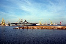
Naval Station Pascagoula was located on Singing River Island and was homeport to several Navy warships, as well as a large Coast Guard contingent.
Naval Station Pascagoula was decommissioned as part of the 2005 BRAC recommendations and ceased operations in 2006.