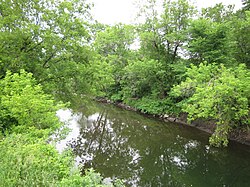
Passumpsic River
The East Branch originates about 1/2 mile southeast of Sukes Pond, Brighton, in Essex County.
It goes through Hartwellville, in the town of East Haven, then crosses into Caledonia County for good.
In Burke, a mile downstream, it is joined on the south by Flower Brook which flows mainly from the east.
The northeast and northwest sides of Burke Mountain drain into Dish Mill Brook, thence into the East Branch of the Passumpsic River.
The river turns south, near the Calendar Brook Road intersection with Route 5.
The two branches merge near East Burke Road, just northeast of where VT 114 intersects with US 5.
Miller Run Valley is a sufficiently prominent feature to be followed by Interstate 91 instead of Route 5.
The river proceeds to the Route 5 bridge and from there to the Vail Hydro Dam.
The river encounters the Vail Hydro Dam and runs to a gravel pit.
The river proceeds from the gravel pit and railroad tracks to the Great Falls Dam downstream.
It proceeds to the Rapids after a sharp bend downstream across from the Green Mountain Trailer Park above the mall at St. Johnsbury Center.
Across from the Green Mountain Trailer Park, it flows downstream to the Price Chopper store on the corner where river and the railroad come close together.
The river enters from St. Johnsbury through the corner of Waterford, in the northeastern part, and gradually turns and flows south, emptying into the Connecticut about 2.5 miles (4.0 km) from the northeastern corner of the town.
Water Andric enters from the west and south just north of Kitchell Hill.
Joes Brook enters it from the south and west just north of Barnet Center.
[6] The first extends from the mouth of the Passumpsic River in Barnet, to the northwest corner of the town of Waterford, on the railroad.
The fourth terrace on the west side of the river is part of the next basin, which is in St. Johnsbury and Lyndon.
[6] Every stream from either side of the valley has its large terraces to correspond with those of the Passumpsic River.
[6] The third basin includes the east branch of the Passumpsic River which runs through the Town of Burke.
The Passumpsic River sustains several dams that produce hydroelectric power for the region.
Central Vermont Public Service (CVPS),[7] operates the Passumpsic, Pierce Mills, Arnold Falls, and Gage dams.
[8] Major Rogers led his rangers to the mouth of the Passumpsic on their retreat from the attack on the Abenaki Indians at St. Francis, Quebec in 1759.
She then decommissioned, transferred to the Military Sealift Command, was redesignated USNS Passumpsic (T-AO-107), and continued to serve in support of the U.S. Navy with a civilian crew as a United States Naval Ship until 1991.