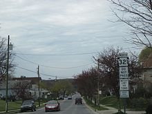
Pennsylvania Route 321
Plans were made to construct the Kinzua Dam in 1960, and several new roads would need to be built to accommodate the reservoir including a relocation of PA 68.
PA 321 begins at an intersection with US 219 in the community of Wilcox in Jones Township, Elk County, heading north on two-lane undivided Buena Vista Highway.
The route runs through Dahoga and continues along the eastern border of Allegheny National Forest, with a Buffalo and Pittsburgh Railroad line a short distance to the west of the road.
The route heads into the borough of Kane and becomes Westerberg Way, running through industrial areas as it crosses an abandoned railroad line and comes to an intersection with US 6.
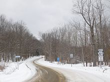
[3][5] PA 321 winds north and serves the Tracy Ridge Trailhead, which consists of a campground and hiking trails leading to the reservoir.
[18][19][20] The roadway between Kane and Red Bridge was improved by Works Progress Administration labor between 1929 and 1930 in order to "get the rural areas 'out of the mud'."
[26] A meeting was held on February 24, 1960, between state and federal officials to discuss the road relocations for the dam construction, including PA 68.
[28] The next month, the Special Highways Committee of the Kane Chamber of Commerce planned to meet with the supervisor of the Allegheny National Forest to discuss access roads to the Kinzua Dam.
[40] On June 20, 1963, officials from the borough of Kane met with district highway engineer Stanton Funk to determine the progress of improving PA 321.
The state had no plans to build the new alignment of PA 321 north of Red Bridge; a tentative route was decided upon but no work had begun.
The section of PA 321 between Kane and Red Bridge, known as the Kinzua Road, was resurveyed in summer 1963 and advanced to the design stage, with funding split between the PDH and the U.S. Forest Service.
[44] Plans were made in 1964 to realign PA 321 to follow Hacker Street in Kane to access the Kinzua Road, avoiding the downtown area along US 6.
[32] On May 28, 1966, it was announced that the State Highways Commission would hold a meeting concerning road projects in the Clearfield District on June 1, asking for input from residents.
[48] At the meeting, Westerberg presented a need for improved highways in McKean County, including completing PA 321 in an expedited manner in order to provide access between Kane and Kinzua Lake.
[49] On July 20, 1966, Westerberg announced that a construction notice would be posted for the section between the Elk County line and Kane, with work to begin pending public hearings.
[57] On June 19, 1964, Representative Victor Westerberg asked that the PDH give priority to three road projects in McKean County, including PA 321, to help improve access to the Kinzua Dam.
[74] By October, final touches were being put in place on the section of the route south of Red Bridge, which were slated to be finished in spring 1967.
[34] The same month, the section between Red Bridge and PA 59 was again placed for review for more revisions to be made while the 4 miles (6.4 km) to the north of Kane was surveyed but without funding.
[95] By the later part of the month, a lot of progress was made on building the road north of Red Bridge, although construction was slowed by rainy weather; the relocation was on target for a 1968 completion date.
[97] By October 1967, the section between Red Bridge and PA 59 was partially complete, but was impassable at several points and in need of a repave to handle heavy traffic.
[100] By August of that year, the section between Red Bridge and PA 59 was paved while finishing touches on berms and guardrails were underway; the road remained closed to traffic and was planned to be opened in September.
The construction of PA 321 south of Kane was still scheduled to begin later in the year, but the project was sent to the redesign stage for modifications to be made to the Baltimore and Ohio Railroad crossing to avoid grade changes.
At this hearing, it was mentioned that it was decided to route PA 321 through Kane rather than along an eastern bypass as the borough was intended to be a destination for motorists using the highway.
An alternate alignment was considered to provide a better intersection with US 6; however, it would have cost $1,123,000 and would have required taking two properties along with cutting off a railroad siding to a plant.
[114] On September 14, 1970, the borough of Kane was assured that it would receive 95 percent state aid for the $80,000 cost to lower the sanitary sewer on Hacker Street for construction of the route.
[116] In late April, the opening of bids for the section of PA 321 through Kane was postponed due to approval needed from the Public Utilities Commission on changes made to the nearby Baltimore and Ohio Railroad siding.
The state had reached an agreement with the Wilcox Area Industrial Development Corporation to use the land for the bypass and made an exchange with the baseball field for it to be built in a new location.
[89] The bidding for this section of PA 321 was pulled on December 17 and postponed to February or April 1972 because revisions were needed to account for transition in funding for the Wilcox bypass from the PDH to PennDOT, in which the state would do bonding and the projects would go through the legislature as bills and be signed by the Governor.
[120] Concrete paving for the route between Wilcox and East Kane was scheduled to begin by September 1, 1974, with the road possibly open to traffic in the fall.
[135][136] A total of 200 people were in attendance for the ceremony, including Senator Frame, Congressman Johnson, Representative Westerberg, Kane Mayor Edgar James, and other local officials.