Pennsylvania Route 371
The eastern terminus is at the New York state line in Damascus Township where it crosses the Delaware River on the Cochecton–Damascus Bridge.
PA 371 was originally designated along the turnpike route in 1936 by the Department of Highways from Great Bend to Damascus.
The route heads to the east, but soon begins to curve to the north, entering the community of Belmont Corners.
PA 371 heads eastward through fields until an intersection with "Crossroad", where it turns to the southeast towards the center of Mount Pleasant Township.
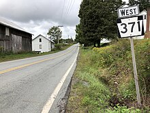
The highway continues on the southeast pattern for a distance, past a large farm and into more forests nearby.
A short distance later, the highway heads through the rural farmlands until entering the community of Niagara.
PA 371 continues through rural farmlands until a hairpin turn in the deep forests nearby.
At the end of the eastern pond, PA 371 turns to the northeast crossing a creek and into the community of Tyler Hill.
[2] Records indicate that the alignment of PA 371 was first constructed as a cut from the Delaware River to the community of Great Bend, Pennsylvania, in 1791 through Wayne and Susquehanna Counties.
The turnpike was used for transportation of farmers' goods and stock along with a route for pioneers to use for heading westward.
The alignment of what is now PA 371 eventually became littered with a large rate of development, with nineteenth-century style buildings constructed in Damascus.