New York State Route 97
Its most famous feature is the Hawk's Nest, a tightly winding section of the road along the Delaware River, located a few miles north of Port Jervis.
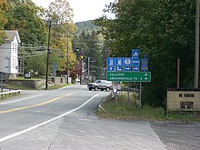
The route quickly bends north, intersecting with Hook Road, which connects to the golf course and nearby fishing area.
In Pond Eddy, NY 97 intersects with County Route 41 (CR 41), which proceeds north as High Road while crosses the nearby Pond Eddy Bridge into Shohola Township, Pennsylvania and the unsigned quadrant State Route 1011 on the opposite shore.
[5] Bending northwest once again, NY 97 continues alongside the river, entering a small commercial stretch through the town of Lumberland, before turning southwest once again.
After leaving Barryville, NY 97 parallels CR 21 for a short distance, continuing west through the town of Highland alongside the Delaware River.
[5] After Minisink Ford, NY 97 bends northward along the river as a two-lane dense woods road through the town of Highland.
Through Tusten, NY 97 makes several bends to the north, before maintaining a long northwest stretch after Grassy Swamp Road.
Passing west of Rock Lake, NY 97 enters the hamlet of Tusten, where it bends northward again and soon intersecting with the western terminus of CR 23 (Lumberland–Mount Hope Road).
NY 97 continues northwest, running along the eastern edge of Narrowsburg, passing Glenn Cove Cemetery, where it intersects with Kirk Road.
Now paralleling the Southern Tier Line once again, the route continues through the town of Tusten, running north as a two-lane residential street.
At the end of the bend, CR 114 (Lake Huntington Road) intersects with NY 97, connecting the route to the Cochecton–Damascus Bridge and PA 371.
[5] After Long Eddy, NY 97 bends northeast through the town of Fremont, intersecting with Kellams Bridge Road.
Through Hancock, NY 97 becomes a two-lane woods road, winding north and soon northeast into the hamlet of Pea Brook.
[5] Pea Brook consists of a few homes and upon leaving, NY 97 returns to the two-lane woods road it was beforehand.
After Somerset Lake, the route bends northwest and returns to the railroad tracks and the Delaware River in the hamlet of Stockport.
In Hancock, NY 97 becomes a two-lane commercial street, paralleling the railroad tracks into the downtown section after crossing the East Branch of the Delaware River.
[6] When the plans for a new highway through the corridor of NY 97 were initially drawn up, it was to bypass what became the Hawk's Nest in favor of a shoreline route.
However, the Erie Railroad refused to sell the necessary right-of-way, forcing the state to construct the improved road along the cliffside instead.
[2][9] In 1932, then-Governor Franklin D. Roosevelt signed legislation designating NY 97 as the "Upper Delaware Scenic Byway".
In May 1939, rest of future-NY 97 was proposed by the New York State Highway Department to become NY 17L from Hancock to Bradley's Corners.
The Orange County Chamber of Commerce wanted one designation for the entire stretch of highway from Hancock to Port Jervis, which shared NY 97.
[10] The Route Ninety-Seven Council had been created several months prior to advocate for designating the entire road as NY 97.
[11] Walter Schwartz, the chairman of the highway committee for Sullivan County's Board of Supervisors, announced on May 12 that he would discuss with the state about the NY 17L/NY 97 ordeal.