Pungwe River
[3][4] It rises below Mount Nyangani in the Eastern Highlands of Zimbabwe and then flows southeastwards through the Manica and Sofala provinces of Mozambique.
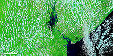
Large seasonal wetlands form around the Pungwe and Urema rivers in the rift valley section.
The quantities transferred to are limited to a maximum of 0.7 cubic metres (25 cu ft)/second by the provisions of a water permit and system design.
Consequently, a fixed abstraction of 60,480 cubic metres (2,136,000 cu ft) per day by Mutare city has been adopted as water demand from the Pungwe River.
The Mutasa Rural District is also expected to draw water from the Pungwe pipeline to supply villages along its route.