Regional Ocean Modeling System
The vertical grid can be squeezed or stretched to increase or decrease the resolution for an area of interest, such as a thermocline or bottom boundary layer.
Grid stretching in the vertical direction follows bottom topography, allowing for the idealized flow of water over features such as seamounts.
In both the vertical and horizontal directions, the default equations use centered, second-order finite difference schemes.
[2] In general, the physical schemes used by ROMS are based on three governing equations: Equations are coupled to solve for five unknowns at each location in the model grid using numerical solutions: ROMS uses an open-access source code that can be downloaded by filling out an online request form.
To download the source code a user must create an account and file a request with the developers on the ROMS website.
Biogeochemical, bio-optical, sea ice, sediment, and other models can be embedded within the ROMS framework to study specific processes.
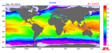
[10] ROMS modeling efforts are increasingly being coupled with observational platforms, such as buoys, satellites, and ship-mounted underway sampling systems, to provide more accurate forecasting of ocean conditions.
These integrated ocean modeling systems use ROMS for the circulation component, and add other variables and processes of interest.