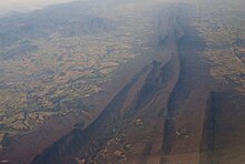
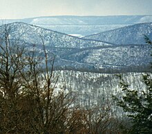
Ridge-and-Valley Appalachians
The ridge and valley system presents an important obstacle to east–west land travel even with today's technology.
In the era when animal power dominated transportation, there was no safe way to cross east–west in the middle of the range; crossing was only possible nearer its extremes except for a few rough passages opened mid-range during the colonial era, including Cumberland Gap, Braddock's Road, and Forbes Road.
They form a broad arc between the Blue Ridge Mountains and the Appalachian Plateau physiographic province, which includes the Allegheny and Cumberland plateaus.
The Valley and Ridge Province was formed during the Alleghanian orogeny, a mountain-building event that occurred between 325 and 260 million years ago.
The evidence points to a wearing down of the entire region to a low level with little relief, so that major rivers were flowing in unconsolidated sediments unaffected by the underlying rock structure.