Rifle, Colorado
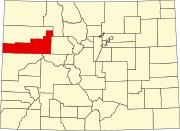
Rifle is a home-rule municipality in, and the most populous community of, Garfield County, Colorado, United States.
[7] Rifle is a regional center of the cattle-ranching industry located along Interstate 70 and the Colorado River just east of the Roan Plateau, which dominates the western skyline of the town.
[9] The land on which Rifle resides was once in the heart of the Ute Nation, a classification of the Indigenous peoples of the Great Basin.
The most common tribe in the area were the Tabagauche, who hunted and lived on the land slightly to the east of Rifle in the Roaring Fork Valley.
Due to their location, the Tabagauche were somewhat less exposed to White settlers, and to some extent their ways remained less altered than other native peoples.
Meeker had no training or knowledge of Ute culture, and launched into a campaign centered on sedentary agriculture and European-American schooling.
The aftermath of the conflict resulted in nearly all members of the Ute nation being forcibly removed from Colorado into eastern Utah, although the federal government had formerly guaranteed them the land on which they were residing.
Good grazing practices were not in place, and the summer pastures at the top of the Roan Plateau were contested.
Rifle is located in the east portion of the Piceance Basin, which is home to different forms of fossil fuels, the largest quantity of which is oil shale.
The Roan Plateau is accessible from the JQS Trail, located 3 miles (5 km) north of Rifle, or from the Piceance Creek road.
Colorado State Highway 13 intersects I-70 and US-6, passing through the southern and western parts of Rifle, then leading north 41 miles (66 km) to Meeker.
One week out of the year, the city bustles with activities surrounding family and professional rodeos, Xtreme bull riding, live music, and a demolition derby.
On August 10, 1972, Christo and Jeanne-Claude completed the Valley Curtain project at Rifle Gap, 6 miles (10 km) north of town.