Rip Point
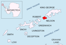
Rip Point (62°14′15″S 58°58′45″W / 62.23750°S 58.97903°W / -62.23750; -58.97903) is a point on Nelson Island forming the south side of the east entrance to Fildes Strait, in the South Shetland Islands.
The name appears on a British Admiralty chart showing the results of a survey by DI personnel on the Discovery II in 1935.
This article incorporates public domain material from "Rip Point".
Geographic Names Information System.
This Nelson Island, South Shetlands location article is a stub.