River mile
[2] Also, the river mile zero for the Lower Mississippi River is located at Head of Passes, where the main stem of the Mississippi splits into three major branches before flowing into the Gulf of Mexico.
Locations of facilities such as wastewater treatment plants and water quality measurement sites are referenced via river miles.
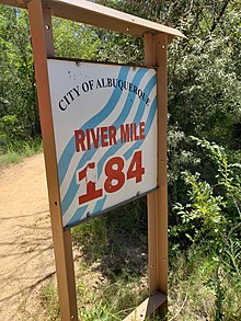
[8] Another example of a River Mile System is utilized by the U.S. Bureau of Reclamation, in New Mexico, on the Rio Grande.
As mentioned earlier in this system the further you go up stream the higher the river mile number.
The U.S. Army Corps of Engineers uses river miles for its navigation maps.