Rock mechanics
[1] The structure could include many objects such as a drilling well, a mine shaft, a tunnel, a reservoir dam, a repository component, or a building.
[5] Field observations, deep drilling, and geophysical surveys, can all give necessary information to develop a safe construction plan and create a site geological model.
[5] The level of investigation conducted at this site depends on factors such as budget, time frame, and expected geological conditions.
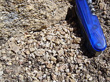
Maps can provide information on the rock type of the site, geological structure, and boundaries between bedrock units.
[5] Creating a borehole is a technique that consists of drilling through the ground in various areas at various depths, to get a better understanding of the sites geology.