Rouge National Urban Park
The southern portion of the park is situated around the mouth of the river in Toronto, and extends northwards into Markham, Pickering, Uxbridge, and Whitchurch-Stouffville.
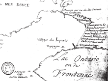
[4] Water from glaciers melting 12,000 years ago formed ancestral Lake Ontario, which covered this entire area.
Outcrops of rock formed during the last glacial period found in Rouge National Urban Park are important to geologists studying seismic activity, in particular the risk of earthquakes in the GTA.
Palaeolithic nomadic hunters, Iroquoian farmers, early European explorers, and the multicultural suburban population that one can see around the park today are all part of this history.
Since humans began living in the area of the present Great Lakes-St Lawrence Lowlands in Ontario, many groups of people made the lands and waters now protected in Rouge Park their home.
The river and its valleys, uplands, forests and wetlands, along with the animal and plant species that lived here, sustained small nomadic groups, and later on larger, permanent settlements long before the rapid urbanization of the 20th century altered the landscape dramatically.
Varley, one of the renowned Group of Seven painters, captured the banks of the Rouge River in Markham on canvas during the 1950s as a lasting memory of their beauty.
[11] Farmers already cultivating land within the subsumed park were granted leases up to thirty years by the federal government.
On January 27, 2025, Transport Canada transferred the remaining portion of the Pickering Airport Lands to the national park.
The civil society came up with their own expertise to validate their ecologically based arguments that could also stand up to competing alternative positions.
[14] A number of projects and initiatives are underway as part of the Rouge National Urban Park establishment process.
There is an official trail in the Rouge National Urban Park where the hill can be viewed from but it does not allow access to the landfill area.
Dirt trails to the hill have been created by patrons of the park who wish to gain a better view of Eastern Greater Toronto as it is one of the tallest points in the area.
Several education and orientation centres, facilities, signage and interpretive panels are being planned in the Toronto and Markham areas of the park.
Beginning in 2016, students from the University of Toronto Scarborough (The Arts & Science Co-op and Masters of Environmental Science Departments) and the Hub (the university's center for entrepreneurship) have worked in collaboration with Parks Canada to release the Rouge App, an application designed to provide park visitors with an interactive and informative guide in the palm of their hand.
[17] Information was collected from Parks Canada staff, indigenous communities, locals, scientists and historians for content.
[19] Parks Canada has a partnership with iNaturalist, an online platform (and App) where people can upload observations of plant, insect and animal life in their area and contribute to citizen science.
Bioblitz are day (or multiday) events where visitors can interact with scientists and community members to find specific species of plants, insects or animals.
The TRCA (Toronto and Region Conservation Authority) has a collection of thematic layers containing information about the watersheds that can be linked together by geography.
These layers are used for decision-making support and solutions to ecological restoration, property acquisition, fisheries management, planning and floodplain mapping.
[25] The David Suzuki Foundation has also used GIS and spatial analysis to map the value of natural capital in the Rouge National Park.
[26] This urban park features numerous fauna such as white-tailed deer, mice, opossums, raccoons, hawks, coyotes, skunks, ducks, beaver, bald eagles, bears, shrews, red foxes, turkeys, weasels, golden eagles, river otters, kestrels, moles, swans, minks, bats, woodchucks, and porcupines.
The proof of understanding behind these results has come from the fact that in younger wetlands the iron-reducing bacteria maybe adding a methane group to the inorganic mercury causing increase in production of MeHg.
On the other hand, the organic matter that gets accumulated in the aged wetlands has the ability to bind inorganic mercury so that bacterial methylation is not able to take place.
Rouge National Urban Park protects large tracts of Class 1 farmland, the rarest and most fertile soil in Canada.
[29] They also contribute to the ecosystems within the watershed by creating habitat structures like raptor posts for owls and hawks to perch onto, which will regulate rodent populations.
It complements Ontario's Greenbelt Act and goes further by obligating the Government of Canada to protect the park, and its ecosystems, cultural artifacts, and native wildlife.
To provide a safe and recreational environment for visitors and maintain biodiversity, it is important to identify these sources and better manage the risks.
Further downstream, a breeding area for salmon and trout was negatively affected due to harm from flash floods and pollution.