Santa Rosa Island, Florida
Spanish settlements in the area were abandoned in 1561, following damage from storms, lack of supplies resulting in famine, and conflicts with the Pensacola natives.
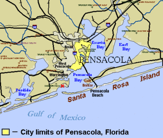
The colony, Presidio Isla de Santa Rosa, was hit by hurricanes in 1741 and 1752 forcing the settlers to relocate across the bay to what is now Pensacola.
After the outbreak of the American Civil War, some of the Union troops located within Confederate Florida retreated to Fort Pickens on the island.
[7] On July 8, 1950 the federal government conveyed an 875-acre (3.54 km2) parcel of Santa Rosa Island with 3 miles (4.8 km) of Gulf frontage to Okaloosa County.
The twelve-mile (19 km) long beach road onto U.S. Air Force property, west of the Okaloosa Island portion of Santa Rosa Boulevard, was unguarded and accessible into the 1990s, but heightened security concerns have since led to it being guarded or blocked at all times.
Various military missile launch and test facilities exist on Santa Rosa Island south and southwest of Hurlburt Field.
[citation needed] One of the final missions in the Florida Phase of the US Army's Ranger School is conducted on Santa Rosa Island.