Scottish island names
[3][4][5][6] By the sixth century AD, scholars of early Insular history often begin to talk about four geographically separate forms of British: Welsh, Breton, Cornish, and the now extinct Cumbric language.
It is clear that whenever place names are recorded at an early date as having been transposed from a form of P-Celtic into Gaelic that this occurred prior to the transformation from "Old British" into modern Welsh.
It is a term used for the language(s) thought to have been spoken by the Picts, the people of northern and central Scotland in the Early Middle Ages.
[10] However, there is virtually no direct attestation of Pictish short of the names of people found on monuments in the lands controlled by the Picts - the area north of the Forth-Clyde line in the Early Middle Ages.
[11] Many of these monuments include elaborate carved symbols, but an understanding of their significance has so far proved as elusive as interpretation of the few written fragments, which have been described as resembling an "odd sort of gibberish".
Old Gaelic is a Goidelic language that arrived via Ireland due to the growing influence of the kingdom of Dalriada from the 6th century onwards.
This the oldest known form of the Goidelic languages, which is known only from fragments, mostly personal names, inscribed on stone in the Ogham alphabet in Ireland and western Britain up to about the 6th century.
Norn is an extinct North Germanic language that developed from Old Norse and was spoken in Shetland, Orkney and possibly Caithness.
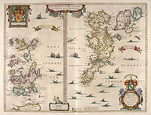
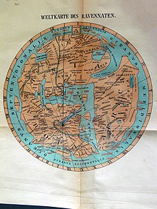
This document frequently used maps as a source of information and it has been possible to speculate about their modern equivalents based on assumptions about voyages made by early travellers 300–400 years prior to its creation.
[Note 2] The presence of the monastery on Iona led to life in this part of Scotland in the Early Middle Ages being relatively well recorded from the mid-6th to the mid-9th century.
Norse settlers in Scotland had a significant influence on toponyms from the 9th century onwards although there is little contemporary documentation of this period of Scottish history by those who lived there.
From 849 on, when Columba's relics were removed in the face of Viking incursions, written evidence from local sources all but vanishes for three hundred years.
Pytheas of Massilia visited Britain – probably sometime between 322 and 285 BC – and described it as triangular in shape, with a northern tip called Orcas.
[22] Writing in the 1st century AD, the Roman geographer Pomponius Mela called the islands of Orkney Orcades, as did Tacitus in 98 AD, claiming that his father-in-law Agricola had "discovered and subjugated the Orcades hitherto unknown"[22][23] (although both Mela and Pliny the Elder had previously referred to the islands[21]).
Writing about 80 years later, in 140-150 AD, Ptolemy, drawing on the earlier naval expeditions of Agricola, wrote that there were only five Ebudes (possibly meaning the Inner Hebrides) and Dumna.
[26] For the individual Hebridean islands, Islay is Ptolemy's Epidion, Malaios is Mull and his Scetis is presumed to be Skye (although it is not listed as one of the Ebudes).
[29] It is therefore possible that some of these records indicate for the first time names used by the islands' inhabitants.There are also various early references from texts written in Ireland and Scotland - 'Celtic' in the list below.
He believes Sasura is the modern Scarba, Minerve is Holy Island and Vinion is Sanda[19] and that Daroeda, Gradena and Longis may be Lunga, The Garvellachs and Muck respectively.
Gammeltoft also lists the Norse saga names of Kjarbarey (Kerrera), Rauney (Rona) and Sandey (Sanday) in the Hebrides and Saltíri, Satíri etc.
Fitzpatrick-Matthews describes Rivet and Smith's identification of Bath in south-west England as "a little fanciful as we are dealing with islands in the northern part of the Irish Sea" and is sceptical about some of their other suggestions for similar reasons.
[52] Fitzpatrick-Matthews chooses Colonsay for Regaina although his reasoning for not preferring the "usual" identification of Rathlin may exaggerate Watson's remark on the topic.
[100] The island of Threave on the River Dee in Dumfries and Galloway takes its name from P-Celtic tref, meaning "homestead".
For example, Hunter (2000) states that in relation to King Bridei I of the Picts in the sixth century: "As for Shetland, Orkney, Skye and the Western Isles, their inhabitants, most of whom appear to have been Pictish in culture and speech at this time, are likely to have regarded Bridei as a fairly distant presence.”[102][103] However, the place names that existed prior to the 9th century have been all but obliterated by the incoming Norse-speaking Gall-Ghaeils.
No Gaelic-derived island names and indeed only two Q-Celtic words exist in the language of modern Orcadians - "iper" from eabhar, meaning a midden slurry, and "keero" from caora - used to describe a small sheep in the North Isles.
It has been argued that the Norse impact on the onomasticon only applied to the islands north of Ardnamurchan and that original Gaelic place names predominate to the south.
For example, Adomnán records Sainea, Elena, Ommon and Oideacha in the Inner Hebrides, which are of unknown location and these names must have passed out of usage in the Norse era.
[112] Nonetheless if we distinguish between names of obviously Norse origin and those with a significant Scots element the great majority are in the former camp.
The Norse often gave animal names to islands and these have been transferred into English in for example, the Calf of Flotta and Horse of Copinsay.