Slope Point
[1] Slope Point lies 24 kilometres (15 mi) south of the small settlement of Waikawa,[2] near the southwestern edge of the Catlins and Toetoes Bay and 70 kilometres (43 mi) east of Invercargill.
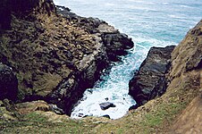
[1] The land around Slope Point is used for sheep farming with no houses anywhere nearby.
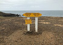
An AA signpost there shows the distance to the Equator and the South Pole, and a small solar-powered lighthouse stands on farmland.
[1] There is no road to Slope Point; it can be reached by a 20-minute walk following dilapidated yellow markers.
Its latitude, longitude is approximately 46.67 S, 169.00 E. There is no public access during the lambing season (September – November).