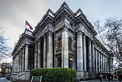
South Australia
This population is the second-most highly centralised in the nation after Western Australia, with more than 77% of South Australians living in the capital Adelaide or its environs.
The state's colonial origins are unique in Australia as a freely settled, planned British province,[9] rather than as a convict settlement.
The South Australian Company established a temporary settlement at Kingscote, Kangaroo Island, on 26 July 1836, five months before Adelaide was founded.
[11] The guiding principle behind settlement was that of systematic colonisation, a theory espoused by Edward Gibbon Wakefield that was later employed by the New Zealand Company.
[13] According to mitochondrial DNA research, Aboriginal people reached Eyre Peninsula 49,000-45,000 years ago from both the east (clockwise, along the coast, from northern Australia) and the west (anti-clockwise).
[14]: 189 The first recorded European sighting of the South Australian coast was in 1627 when the Dutch ship the Gulden Zeepaert, captained by François Thijssen, examined and mapped a section of the coastline as far east as the Nuyts Archipelago.
The act stated that the land between 132° and 141° east longitude and from 26° south latitude to the southern ocean would be allotted to the intended colony, and it would be convict-free.
The Letters Patent,[17] which used the enabling provisions of the South Australia Act 1834 to fix the boundaries of the Province of South Australia, provided that "nothing in those our Letters Patent shall affect or be construed to affect the rights of any Aboriginal Natives of the said Province to the actual occupation and enjoyment in their own Persons or in the Persons of their Descendants of any Lands therein now actually occupied or enjoyed by such Natives.
"[17] Although the patent guaranteed land rights under force of law for the indigenous inhabitants, it was ignored by the South Australian Company authorities and squatters.
[18] Despite strong reference to the rights of the native population in the initial proclamation by the Governor, there were many conflicts and deaths in the Australian Frontier Wars in South Australia.
Survey was required before settlement of the province, and the Colonization Commissioners for South Australia appointed William Light as the leader of its 'First Expedition', tasked with examining 1500 miles of the South Australian coastline and selecting the best site for the capital, and with then planning and surveying the site of the city into one-acre Town Sections and its surrounds into 134-acre Country Sections.
The company's settlement of seven vessels and 636 people was temporarily made at Kingscote on Kangaroo Island, until the official site of the capital was selected by William Light, where the City of Adelaide is currently located.
Sales of land to colonists created an Emigration Fund to pay the costs of transferring a poor young labouring population to South Australia.
[20] The current flag of South Australia was adopted on 13 January 1904, and is a British blue ensign defaced with the state badge.
The most important (but not tallest) is the Mount Lofty-Flinders Ranges system, which extends north about 800 kilometres (500 mi) from Cape Jervis to the northern end of Lake Torrens.
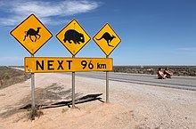
[21] The south-western portion of the state consists of the sparsely inhabited Nullarbor Plain, fronted by the cliffs of the Great Australian Bight.
However, in 2012 Standard & Poor's downgraded the state's credit rating to AA+ due to declining revenues, new spending initiatives and a weaker than expected budgetary outlook.
[30] South Australia receives the least amount of federal funding for its local road network of all states on a per capita and a per kilometre basis.
[33] Wheat, barley, oats, rye, peas, beans, chickpeas, lentils and canola are grown in South Australia.
[37] Renewable energy is a growing source of electricity in South Australia, and there is potential for growth from this particular industry of the state's economy.
Initially, the Governor of South Australia held almost total power, derived from the letters patent of the imperial government to create the colony.
[80] The academic year in South Australia generally runs from the end of January until mid-December for primary and secondary schools.
[84] Tertiary vocational education is provided by a range of Registered Training Organisations (RTOs) which are regulated at Commonwealth level.
The range of RTOs delivering education include public, private and 'enterprise' providers i.e. employing organisations who run an RTO for their own employees or members.
Adelaide Airport provides regular flights to other capitals, major South Australian towns and many international locations.
The River Murray was formerly an important trade route for South Australia, with paddle steamers linking inland areas and the ocean at Goolwa.
[100] At the professional level, the West End Redbacks represent the men's state team, competing in the Sheffield Shield and the Marsh One-Day Cup.
[101] Adelaide City remains South Australia's most successful club, having won three National Soccer League titles and three NSL Cups.
[102] An earlier version of the Adelaide Street Circuit played host to the Australian Grand Prix, a round of the FIA Formula One World Championship, each year from 1985 to 1995.
At present however, the South Australian Rugby League still operates a local semi-professional competition consisting of both junior and adult teams from across Adelaide.