Stream gauge
Some gauging stations are highly automated and may include telemetry capability transmitted to a central data logging facility.
Low gradient (or shallow-sloped) streams are highly influenced by variable downstream channel conditions.
The technicians and hydrologists responsible for determining the rating curve visit the site routinely, with special trips to measure the hydrologic extremes (floods and droughts), and make a discharge measurement by following an explicit set of instructions or standard operating procedures (SOPs).
This record then serves as an assessment of the volume of water that passes by the stream gauge and is useful for many tasks associated with hydrology.
A variety of hydraulic structures / primary device are used to improve the reliability of using water level as a surrogate for flow (improving the accuracy of the rating table), including: Other equipment commonly used at permanent stream gauge include: Water level gauges: Discharge measurements of a stream or canal without an established stream gauge can be made using a current meter or Acoustic Doppler current profiler.
[4] In the United States, the U.S. Geological Survey (USGS) is the principal federal agency tasked with maintaining records of natural resources.
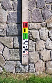
Technicians then install equipment that measures the stage (the elevation of the water surface) or, more rarely, the velocity of the flow.
However, a review of existing gauges raised serious concerns about the reliability of the data of a minority of stations, due in part to ongoing funding problems.
At few other locations, Bangladesh Inland Water Transport Authority maintains a few gauges to provide advisories for navigational purposes.
In Sri Lanka stream and rivers are monitored by Hydrology and Disaster Management Division a branch of Irrigation Department.