Submarine landslide
Submarine landslides take place in a variety of different settings, including planes as low as 1°, and can cause significant damage to both life and property.
Recent advances have been made in understanding the nature and processes of submarine landslides through the use of sidescan sonar and other seafloor mapping technology.
Common causes of landslides include: i) presence of weak geological layers, ii) overpressure due to rapid accumulation of sedimentary deposits, iii) earthquakes, iv) storm wave loading and hurricanes, v) gas hydrate dissociation, vi) groundwater seepage and high pore water pressure, vii) glacial loading, viii) volcanic island growth, and ix) oversteepening.
An example of landslides caused by overpressure due to rapid deposition occurred in 1969 on the Mississippi River delta after Hurricane Camile struck the region.
Earthquakes provide significant environmental stresses and can promote elevated pore water pressure which leads to failure.
[2][8][9] Slope failures due to volcanic island growth are among the largest on earth, involving volumes of several cubic kilometres.
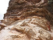
This is clearly seen on the Norwegian continental slope where the location of landslides such as Storegga and Traenadjupet is related to weak geological layers.
However the position of these weak layers is determined by regional variation in sedimentation style, which itself is controlled by large scale environmental factors such as climate change between glacial and interglacial conditions.
Despite the variety of different landslides present in submarine environment, only slides, debris flow and turbidity currents provide a substantial contribution to gravity driven sediment transport.
[2][3] Recent advances in 3-D seismic mapping have revealed spectacular images of submarine landslides off Angola and Brunei, showing in detail the size of blocks transported and how they moved along the sea floor.
[13][14] It was initially thought that submarine landslides in cohesive sediments systematically and sequentially developed downslope from slide to debris flow to turbidity current through slowly increasing disintegration and entrainment of water.
Landslides can have significant economic impacts on infrastructure such as the rupture of fibre optic submarine communications cables and pipelines and damage to offshore drilling platforms and can continue onwards on slope angles as low as 1°.
[1][3][5] Further destruction of infrastructure occurred when Hurricane Camille hit the Mississippi delta in 1969 causing a landslide which damaged several offshore drilling platforms.
[21] Recent findings show that the nature of a tsunami is dependent upon volume, velocity, initial acceleration, length and thickness of the contributing landslide.
In most cases the submarine landslides are noticeably subcritical, that is the Froude number (the ratio of slide speed to wave propagation) is significantly less than one.
Furthermore, shallower waters are generally closer to the coast meaning that there is less radial damping by the time the tsunami reaches the shore.
Conversely tsunamis triggered by earthquakes are more critical when the seabed displacement occurs in the deep ocean as the first wave (which is less affected by depth) has a shorter wavelength and is enlarged when travelling from deeper to shallower waters.
[26][27][28][29] During glacial or deglacial times a series of geological processes modified intensely the shallow structure of the submarine continental margin.
The internal structure imaged with seismic methods shows sometimes a transparent or a chaotic character indicating disintegration of the slide mass.