Sunset Drive
Sunset Drive, also known as Southwest 72nd Street is a 12.5-mile-long (20.1 km) east–west arterial road traversing the southwestern suburbs of Miami, Florida, from the northwestern portions of the Kendall area to Coral Gables.
A central portion of Sunset Drive is maintained by the Florida Department of Transportation as State Road 986 (SR 986), which runs from the Homestead Extension (HEFT) underpass to Southwest 69th Avenue[1] and is signed through South Miami to US 1.
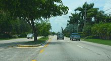
[5] The road passes one block to the south of the Miccosukee Golf & Country Club, and continues east between the backs of residential neighborhoods for another two miles (3.2 km), older than those lying to the west, with the only break being Miami Sunset Senior High.
After crossing Southwest 127th Avenue, Sunset Drive's character changes as it passes by churches, schools, large-lot houses and market gardens until it reaches the HEFT.
[9] Like at its western terminus, the FDOT inventory recognises Sunset Drive as far east as Red Road (approximately 1.3 miles (2.1 km)) as lying off the State Highway System.
[2][7] East of US 1, Sunset Drive scales down to become an undivided two-laned shopping street for the next two blocks, reaching Red Road (Southwest 57th Avenue) after 1⁄4 mile (400 m).