Swift County, Minnesota
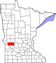
[4] Swift County is in west central Minnesota and consists of 757 square miles (2,000 km2) with three tiers of seven townships each.
The Indians had grievances against the government, including delays in sending annuities that caused near starvation several times.
By late September 1862, the Indian War was almost over but the settlers hesitated to venture back to Swift County until 1865, when all danger was apparently over.
The railroad company determined the number of future trading centers (Kerkhoven, DeGraff, Benson, Randall) in the county by locating sites at intervals of approximately 8 miles (13 km).
The Swift County Courthouse was built in 1897 and was listed on the National Register of Historic Places in 1976.
The Pomme de Terre River flows south-southwest through the county's western part, discharging into the Minnesota.
[5] It slopes to south and the west, with its highest point near its northeast corner at 1,240 ft (380 m) ASL.
Caltopo shows the true highpoint to be 1300 ft in elevation about 1/3 of a mile southwest of the Monson State Wildlife Management Area:latitude 45.3046&longitude=-95.3031Appleton Municipal Airport provides general aviation service for Swift County.
[15] In 2016, a dramatic swing against the Democrats in the Rust Belt saw Swift County shifting a massive 36% toward the Republican Party, with Donald Trump winning it over Hillary Clinton by 26%, and further increasing his margin of victory to nearly 30% against Joe Biden in 2020.