Sydney Basin
The Sydney Basin is an interim Australian bioregion and is both a structural entity and a depositional area, now preserved on the east coast of New South Wales, Australia and with some of its eastern side now subsided beneath the Tasman Sea.
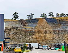
Around 5,000 metres (16,000 ft) thick, the Sydney Basin consists of Permian and Triassic sedimentary rocks, which stretches from Newcastle in the north to Batemans Bay in the south, and west to the Great Dividing Range.
[3] According to NSW Primary Industries, the basin extends through approximately 350 kilometres (220 mi) of coastline from Newcastle in the north to Durras Lake (near Batemans Bay) in the south.
[10] Late Permian uplift associated with the New England foreland loading phase resulted in the formation of depocentres with the northeast Sydney Basin with best preserved marine fossils.
The basin underwent a final phase of deformation (thrusting) in the Middle Triassic where it was uplifted to become dry land, with an erosion occurring from this time to the present.
Extension and breakup in the Tasman Sea beginning in the Late Cretaceous resulted in the current structural boundaries of the basin's eastern margin.
In the south and west the Basin finishes in cliff lines formed on sandstones and conglomerates of the primary Permian sediments, with waterfalls being widespread on all escarpments.