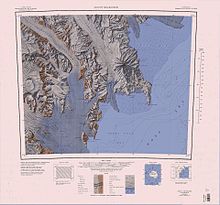
Priestley Glacier
South of Black Ridge on its eastern flank, as it merges into the Nansen Ice Sheet, it is fed by the Corner Glacier.
A steep glacier, 15 nautical miles (28 km; 17 mi) long, draining the east wall of Eisenhower Range between Mount Baxter and Eskimo Point and flowing southeast to its terminus opposite the mouths of the Priestley and Corner Glaciers at the north extremity of Nansen Ice Sheet.
A steep-walled canyon at the head of O'Kane Glacier, indenting the east side of Eisenhower Range between Mount Baxter and Eskimo Point.
First explored by the Northern Party of the British Antarctic Expedition (BrAE), 1910-13, and so named by them because of its location with respect to the Nansen Ice Sheet.
Isolated nunataks located in the north reaches of Priestley Névé, about 15 nautical miles (28 km; 17 mi) south-southwest of Brawn Rocks.
Named by US-ACAN for James E. Brawn, aviation machinist's mate with United States Navy Squadron VX-6 at McMurdo Station, 1966.
Named by US-ACAN for Otto R. Szanto, United States Navy, radio man who served in Antarctic support activities for four seasons at McMurdo Station in the 1960s.
Named by US-ACAN for William G. Wasson, aviation electrician's mate with United States Navy Squadron VX-6 at McMurdo Station, 1966.
So named by the southern party of New Zealand Geological Survey Antarctic Expedition (NZGSAE), 1962–63, because an attempt to establish a station there proved abortive due to steep ice.
Flattish, mainly ice-covered heights, about 7 nautical miles (13 km; 8.1 mi) long, forming a part of the south wall of upper Priestley Glacier to the southeast of Tantalus Peak.
A series of rugged crags descending southeast from Mount Baxter of the Eisenhower Range and forming the south wall of O'Kane Glacier.
[15] This article incorporates public domain material from websites or documents of the United States Geological Survey.