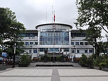
Taguig
[7] Taguig is located alongside the northwestern shores of Laguna de Bay, and is situated in the southeastern portion of Metro Manila.
The city covers about 47.28 square kilometers (18.25 sq mi)[8] and it is bordered by Pasig and Pateros to the north, Makati and Mandaluyong to the northwest, Pasay and Parañaque to the west, Taytay, Rizal to the northeast and Muntinlupa to the south.
According to records, Taguig had nine barrios then, namely: Bagumbayan, Bambang, Hagonoy (Hagunoy), Palingon (Palingong), Santa Ana, Tipas, Tuktukan (Toctocan), Ususan, and Wawa (Uaua).
[26] It was also during the American Colonial Period that the United States government acquired a 25.78 km2 (9.95 sq mi) property of Taguig for military purposes.
This large piece of land, which had a TCT dated 1902, was turned into a camp that became known as Fort William McKinley, named after the 25th president of the U.S. who was responsible for the American colonization of the Philippines.
Fort McKinley was renamed as Sakura Heiei (Cherry Blossom Barracks) and became one of their most important installation and expanded its network of tunnels which served as shelter of the high military officials.
[28] A third facility, the Youth Rehabilitation Center (YRC), was still treated as part of Fort Bonifacio but was later turned into the Makati City Jail.
Among the prisoners held there were some of the country's leading academics, creative writers, journalists, and historians including Butch Dalisay, Ricky Lee, Bienvenido Lumbera, Jo Ann Maglipon, Ninotchka Rosca, Zeus Salazar, and William Henry Scott.
[30] In 1974, the name of Taguig's political subdivisions was changed from "barrios" to "barangays" following the nationwide implementation of the Integrated Reorganization Plan (IRP) under Presidential Decree No.
[36] In 2008, the Taguig City Council created ten new barangays – Central Bicutan, New Lower Bicutan, Fort Bonifacio, Katuparan, North Signal Village, South Signal Village, South Daanghari, North Daanghari, Pinagsama, San Miguel, and Tanyag – by virtue of City Ordinance Nos.
[44] Bonifacio Global City and the surrounding ten Enlisted Men's Barrios (EMBO) barangays were officially recognized as part of Taguig.
[8] The city bordered by Pasig and Pateros to the north, Makati and Mandaluyong to the northwest, Pasay and Parañaque to the west, Taytay to the northeast, and Muntinlupa to the south.
A relatively small area of the city called Ibayo Napindan is located north of the river, adjoining the disputed territories between Pasig, Taguig, and Taytay in Rizal Province.
In 1993, Taguig filed a complaint against Makati over the entirety of Fort Bonifacio and the Enlisted Men's Barangays (EMBOs), claiming these areas were within its territory.
In 2011, the Pasig Regional Trial Court upheld Taguig's claim over the Fort Bonifacio Military Reservation, including the EMBO barangays, and ordered Makati to stop exercising jurisdiction over these areas.
The Supreme Court of the Philippines affirmed this ruling with finality on April 27, 2022, declaring that Bonifacio Global City and the surrounding EMBO barangays were under Taguig's jurisdiction.
Tropical cyclones are relatively common, which resulted in flashfloods in low-lying areas of the city, especially those near major rivers and the Laguna de Bay.
Based on the 2007 census, there were 44,332 migrants in Taguig, and most of these families settled in vast tracts of undeveloped lands that were not commonly found in other cities of Metro Manila.
[93] The City Government of Taguig has undertaken socialized housing projects such as the Family Townhomes, which won the 2009 Galing Pook Awards.
The CMCI ranks cities and municipalities in the country according to five pillars: economic dynamism, government efficiency, infrastructure, resiliency, and innovation.
[104] The Taguig City Government, in partnership with the Department of Agriculture and the Laguna Lake Development Authority (LLDA), is planning to setup the first agri-industrial corridor dedicated to freshwater aquaculture and urban farming.
[110] The city has several industrial areas, most of which are located in barangays Ibayo-Tipas, Palingon, Calzada, Napindan, Western Bicutan, Bagumbayan, and Tanyag.
The city and the Metro Manila area as a whole have an array of attractions for tourists, including monuments, memorials, museums, sports events, and shopping malls.
[112] The city government owned TLC Park along C6 Road in Lower Bicutan is home to lightshows, concerts, and other activities during holiday seasons like Christmas and Valentines.
The vice mayor heads the Taguig City Council consisting of 18 members: 8 councilors from the 1st district, 8 councilors from the 2nd district, the president of the Sangguniang Kabataan (Youth Council) Federation as sectoral representative of the youth, and the president of the Association of Barangay Captains (ABC) as barangay sectoral representative.
The proposed Taguig City Integrated Terminal Exchange, is conceptualized as the primary bus station for buses going to and from Southern Luzon, Visayas, and Mindanao.
[136] The program benefitted 123,000 individuals through allowances as of December 2024, and has produced 4,546 licensed professionals, including engineers, teachers, medical doctors, and lawyers, among others.
[143] TPDH was expanded in 2022, with the construction of a new building that focuses on women and children's health, including chemotherapy and breast clinics, as well as a center for social hygiene.
[153] The Taguig Generals represents the city in the National Basketball League, where they are the most successful team so far with five total titles, including a four-peat of championship wins.
It has also become a destination for various National Basketball Association players when they visit the country, such as LeBron James, Paul George, Jordan Clarkson and Julius Randle.