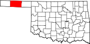
Texhoma, Oklahoma
[4] Founded around the Rock Island Railroad laying tracks through the area, much of the town's local economy is from ranching and livestock.
Before No Man's Land was opened for settlers in 1890, the area now known as the Oklahoma Panhandle was sparsely settled ranchland.
Expansion of the Rock Island Railroad tracks from Liberal, Kansas to Santa Rosa, New Mexico spurred the settlement's formation.
[8] According to the United States Census Bureau, the town has a total area of 0.6 square miles (1.6 km2), all land.
Texhoma students in both Texas and Oklahoma are served jointly by an unusual bi-state arrangement.
[13] Commercial air transportation is available at Liberal Mid-America Regional Airport in Liberal, Kansas,[14] about 62 miles northeast,[15] or at the larger Rick Husband Amarillo International Airport,[16] about 110 miles to the south.
[18] Texhoma High School is housed in a pair of monolithic dome structures.