The Central Pacific hurricane season began on June 1, covering tropical cyclone formation in the region between 140°W and International Dateline.
[2] The season produced twenty-seven tropical depressions, of which twenty-one became named storms, and sixteen strengthened into hurricanes.
[nb 1] Despite high levels of activity, Rachel was the only system to make landfall, bringing floods to Northwestern Mexico and the Southwestern United States.
[1] One tropical storm formed in the Central Pacific Hurricane Center's warning zone and eventually crossed the International Dateline before dissipating.
This timeline documents tropical cyclone formations, strengthening, weakening, landfalls, and dissipations during the season.
Hurricane Alma at peak intensity on May 16, 1990
Storm track of Hurricane Boris
Hurricane Elida shortly after being upgraded to a hurricane
Storm track of Hurricane Fausto
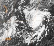
Hurricane Genevieve near peak intensity on July 16, 1990
Hurricane Hernan near peak intensity on July 23, 1990
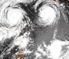
Hurricanes Hernan (top-left), Iselle (top-right) and Tropical Depression Eleven-E (bottom-right) on July 25, 1990
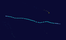
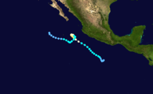
Storm track of Tropical Storm Aka, the only named storm in the Central Pacific in 1990
Hurricane Julio near peak intensity on August 21, 1990
Storm track of Hurricane Lowell
Hurricane Marie near peak intensity on September 11, 1990
Hurricane Odile near peak intensity on September 26, 1990
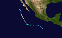
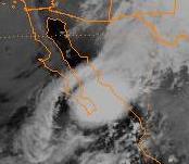
Tropical Storm Rachel
, the only tropical cyclone to make landfall in the 1990 Pacific hurricane season
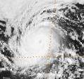
Hurricane Trudy, the strongest tropical cyclone of the 1990 Pacific hurricane season