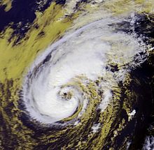
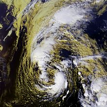
Timeline of the 2001 Atlantic hurricane season

[nb 1] The season officially began on June 1 and ended on November 30, dates that conventionally delimit the period of each year when most tropical cyclones form in the Atlantic basin.

Forming over the northwestern Gulf of Mexico, Allison produced widespread heavy rainfall along its path (most notably across Texas and Louisiana), killing 41 people and inflicting $9 billion (2001 USD) in damage.

[4] Following the season, Allison became the first tropical storm to have its name retired by the World Meteorological Organization.

[nb 3] The storm's impacts extended from the Caribbean Sea to the Bahamas and were most severe in Cuba, cementing its status as one of the costliest cyclones on record there.

[6] This timeline documents tropical cyclone formations, strengthening, weakening, landfalls, extratropical transitions, and dissipations during the season.

Satellite imagery of a large, disorganized tropical storm near peak intensity
Tropical Storm Allison near peak intensity on June 5, 2001
Track of a short-lived tropical depression across the Central Atlantic
Storm path of Tropical Depression Two
Satellite imagery showing a well-organized tropical storm in the eastern Gulf of Mexico
Tropical Storm Barry on August 5, 2001
Satellite imagery of a tropical storm shortly after moving ashore
Chantal after making landfall on the Yucatán Peninsula
Satellite imagery showing a tropical storm near peak intensity southeast of Newfoundland
Tropical Storm Dean near peak intensity on August 27
Satellite imagery of a well-formed hurricane with a large eye
Hurricane Erin at peak intensity on September 9
Satellite imagery showing a well-organized hurricane over the Central Atlantic
Hurricane Felix on the cusp of becoming a major hurricane
Satellite imagery showing a poorly-formed hurricane at its strongest northwest of Bermuda
Hurricane Gabrielle at peak intensity on September 17
Track of a short-lived tropical depression over the southwestern Caribbean Sea
Storm path of Tropical Depression Nine
Satellite imagery of a compact and intense hurricane southeast of Newfoundland
Hurricane Humberto as a Category 2 on September 26
Satellite imagery of a small hurricane north of Honduras
Iris near peak intensity on October 8
Track map of a short-lived and disorganized tropical storm through the Central Atlantic and eastern Caribbean Sea
Storm path of Tropical Storm Jerry
Satellite imagery showing a large tropical storm on the cusp of becoming a hurricane
Karen just prior to becoming a hurricane on October 13
Track map of a tropical storm over the northeastern Atlantic
Storm path of Tropical Storm Lorenzo
Satellite imagery of a powerful hurricane nearing landfall in Cuba
Hurricane Michelle approaching Cuba as a Category 4
Satellite imagery showing a newly transitioned hurricane
Noel after making the transition into a hurricane
Satellite imagery depicting a hurricane near its peak intensity on November 27
Hurricane Olga near peak intensity on November 27