Timeline of the 2005 Atlantic hurricane season
It was the second most active Atlantic hurricane season in recorded history, and the most extreme (i.e. produced the highest accumulated cyclone energy (ACE)) in the satellite era.
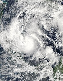
Zeta is only the second December Atlantic storm in recorded history to survive into January, joining Hurricane Alice in 1955.
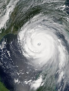
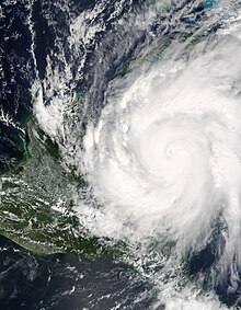
[nb 1] Six hurricanes made landfall or near-landfall on the U.S. during the season: Cindy, Dennis, Katrina, Ophelia, Rita and Wilma.
[1] Record-breaking 2005 hurricanes included: Following the 2005 season, the names Dennis, Katrina, Rita, Stan and Wilma were retired from reuse in the North Atlantic by the World Meteorological Organization.
[7] This timeline documents tropical cyclone formations, strengthening, weakening, landfalls, extratropical transitions, and dissipations during the season.