Timeline of the 2019 Atlantic hurricane season

These dates, adopted by convention, historically describe the period in each year when most tropical systems form.

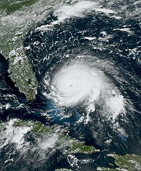
While Lorenzo did not affect land as a Category 5 hurricane, it caused US$367 million in damage and killed 19, with over half of the deaths being attributed to the sinking of a tugboat known as the Bourbon Rhode.

[5][6][7] In March 2021, the name Dorian was retired from reuse in the North Atlantic by the World Meteorological Organization.

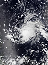
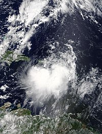
[8] This timeline documents tropical cyclone formations, strengthening, weakening, landfalls, extratropical transitions, and dissipations during the season.

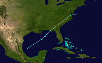
Additionally, figures for maximum sustained winds and position estimates are rounded to the nearest 5 units (knots, miles, or kilometers), following the convention used in the National Hurricane Center's products.

A picture of Hurricane Barry near the Gulf Coast of Louisiana on July 13, 2019
Hurricane Barry shortly after making landfall along the Gulf Coast of Louisiana on July 13
The track of Tropical Storm Chantal. It starts in the northeast Atlantic Ocean and continues horizontally, before taking a turn in the opposite direction toward the end of its life.
Track of Tropical Storm Chantal
Hurricane Dorian as a strong Category 5 hurricane over the Bahamas on September 1, 2019.
Hurricane Dorian at peak intensity while making landfall in the Abaco Islands on September 1
Tropical Storm Gabrielle over the open ocean on September 4. It is somewhat asymmetrical and has an oval shape.
Tropical Storm Gabrielle over the open ocean on September 4
Hurricane Humberto over the open ocean near its peak intensity on September 18.
Hurricane Humberto as a Category 3 major hurricane on September 18
Hurricane Jerry east of the Leeward Islands as a Category 2 hurricane on September 19.
Hurricane Jerry east of the Leeward Islands on September 19
Tropical Storm Karen on September 24, 2019. Land can be seen above and below the storm. The storm is slightly asymmetrical.
Tropical Storm Karen on September 24
An Infrared animation of Hurricane Lorenzo reaching its peak intensity on September 29, 2019.
IR Animation of Hurricane Lorenzo reaching peak intensity, September 29 – SSEC / CIMSS , University of Wisconsin–Madison .
The track of Tropical Storm Nestor. Its track is diagonal, going from the southeast area of the Gulf of Mexico to the coast of the Carolinas.
Track of Tropical Storm Nestor
Hurricane Pablo over the Eastern North Atlantic Ocean on October 27, 2019.
Hurricane Pablo on October 27