Geography of Tonga
Due to the spread out islands it has the 40th largest Exclusive Economic Zone of 659,558 km2 (254,657 sq mi).
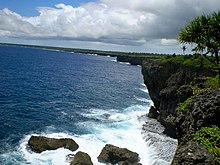
The largest island, Tongatapu, on which the capital city of Nukuʻalofa is located, covers 257 square kilometres (99 sq mi).
The temperature increases from 23 to 27 °C (73.4 to 80.6 °F), and the annual rainfall is from 1,700 to 2,970 millimetres (66.9 to 116.9 inches) as one moves from Tongatapu in the south to the more northerly islands closer to the Equator.
[3] These islands are surrounded by "a protective and resource-rich labyrinth of fringing, apron and off-shore barrier reefs" that have supported most of the human settlement in Tonga ever since the first Lapita People arrived circa 900 BCE.
The volcanic eruption has built the new island to a height of 100 m composed of ash and large rock fragments.
Natural hazards include earthquakes and volcanic activity at Fonuafo'ou (Falcon Shoal/Island) and Late'iki (Metis Shoal/Island).